An independent Canadian knowledge project

Focused and Verified

Canadian knowledge base

Search by keyword

Choose one keyword, or combine two. Broader keywords include their descendants.

Keywords: Indigenous knowledge, rights and heritage

Clear search
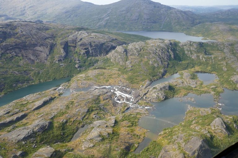
An aerial view of the Mealy Mountains in Labrador.
CA-K1039Places & geography

Akami-Uapishkᵁ-KakKasuak-Mealy Mountains, eastern Canada’s largest national park

Akami-Uapishkᵁ-KakKasuak-Mealy Mountains National Park Reserve in Labrador covers 10,700 square kilometres and is the largest national park in eastern Canada. Its Innu and Labrador Inuit names refer to white mountains and a mountain. The bare, glacier-rounded summits of the Mealy Mountains rise 1,180 metres above Lake Melville.

Factual accuracy review: No recorded challenge

Contributor: Citizen.ca

Verified against cited sourcesVerified on 2026-10-27↗
Photo: Paul Gierszewski · Photo licence: CC BY-SA 4.0 · Credit & context
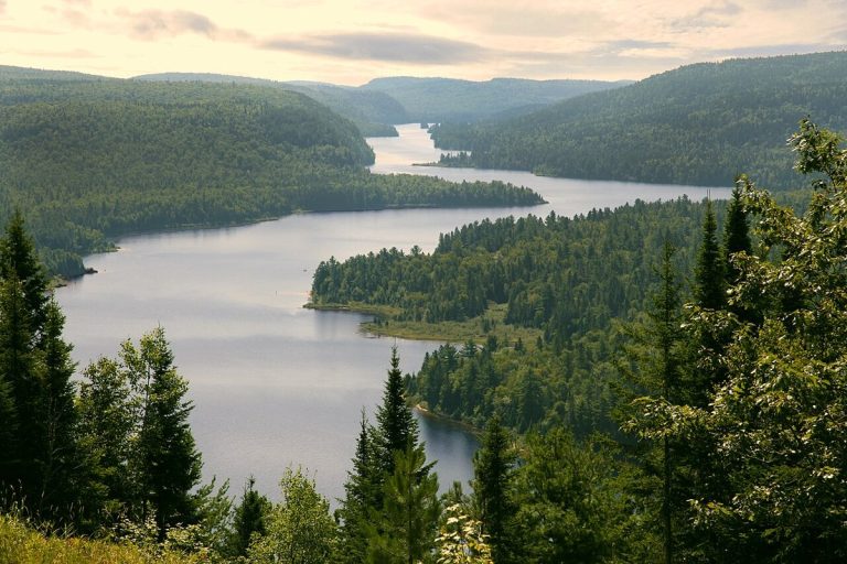
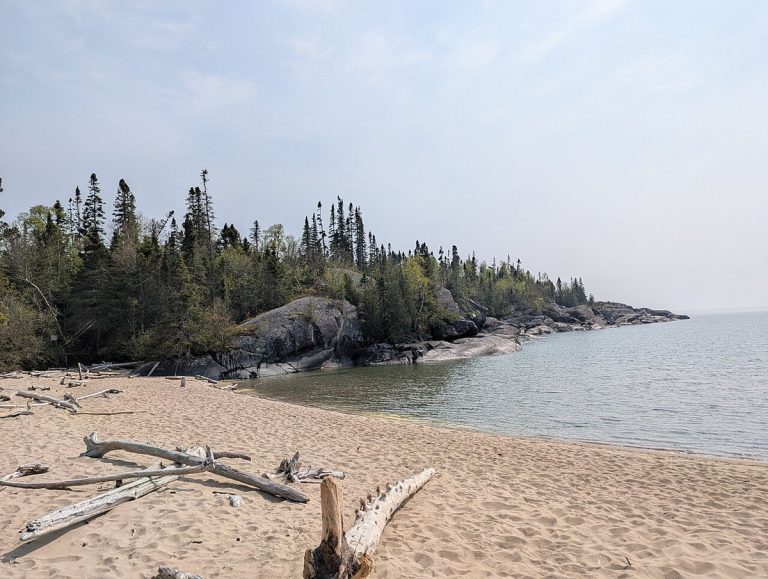
Wapizagonke Lake, La Mauricie National Park.
CA-K1035Places & geography

La Mauricie National Park

La Mauricie National Park in Quebec is both accessible and wild, open to hiking, camping, canoeing, cycling and skiing through the four seasons. It protects a territory where Indigenous knowledge, holidaymaking and logging have all left their mark, at the heart of Mauricie culture.

Factual accuracy review: No recorded challenge

Contributor: Citizen.ca

Verified against cited sourcesVerified on 2026-10-27↗
Photo: Marc-Lautenbacher · Photo licence: CC BY-SA 4.0 · Credit & context
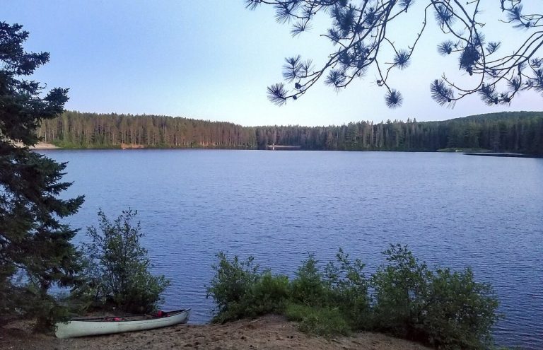
Horseshoe Bay beach, Pukaskwa National Park.
CA-K1032Places & geography

Pukaskwa National Park on Lake Superior

Pukaskwa National Park protects a remote granite shore of Lake Superior in Ontario, with windswept spruce and pine, towering cliffs and secluded sandy beaches. Black bears, loons and moose live here, and the culture of the Anishinaabe First Nations links the park’s wilderness to an ancient human story.

Factual accuracy review: No recorded challenge

Contributor: Citizen.ca

Verified against cited sourcesVerified on 2026-10-27↗
Photo: Hirgax · Photo licence: CC BY-SA 4.0 · Credit & context
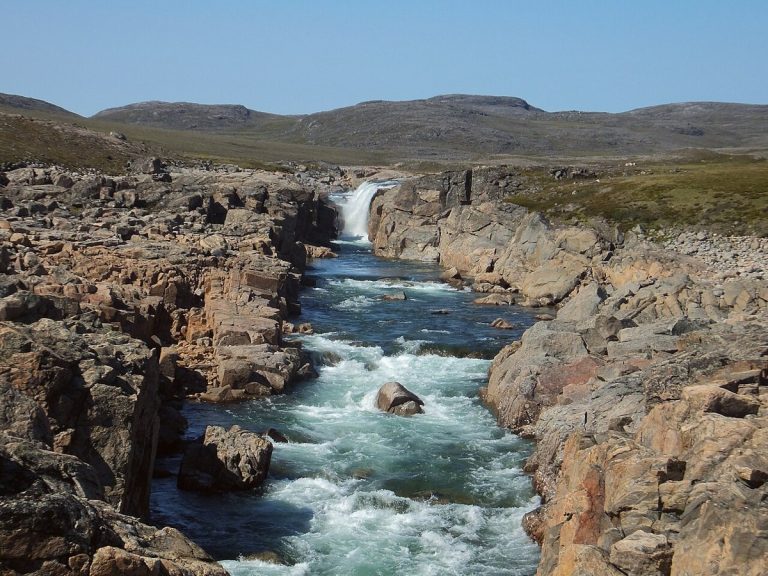
A lake on Beausoleil Island, Georgian Bay Islands National Park.
CA-K1030Places & geography

Georgian Bay Islands National Park

Georgian Bay Islands National Park lies in the world’s largest freshwater archipelago, a place with thousands of years of Indigenous history. Its ecological diversity ranges from dense deciduous forest to the granite outcrops of the Canadian Shield, and the park is reached only by boat.

Factual accuracy review: No recorded challenge

Contributor: Citizen.ca

Verified against cited sourcesVerified on 2026-10-27↗
Photo: Inthegreen13 · Photo licence: CC BY-SA 4.0 · Credit & context
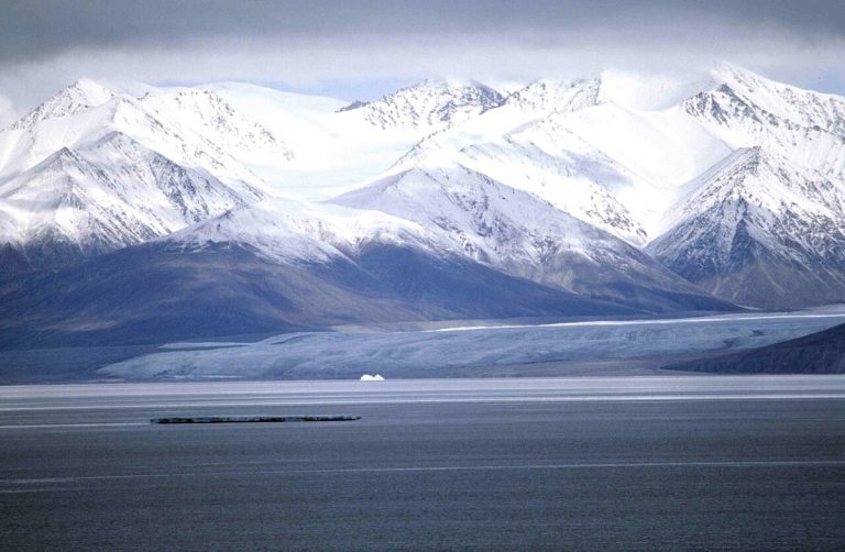
Upper Sila River Falls, Ukkusiksalik National Park.
CA-K1027Places & geography

Ukkusiksalik National Park on Wager Bay

Ukkusiksalik National Park lies along the shores of Wager Bay in Nunavut, a rolling tundra full of wildlife. Polar bears, Arctic wolves and caribou roam a landscape where hundreds of archaeological sites tell the story of Inuit who have lived and travelled here for thousands of years.

Factual accuracy review: No recorded challenge

Contributor: Citizen.ca

Verified against cited sourcesVerified on 2026-10-27↗
Photo: Paul Gierszewski (Gierszep) · Photo licence: CC BY-SA 4.0 · Credit & context
Sirmilik Glacier, Bylot Island.
CA-K1026Places & geography

Sirmilik National Park, Bylot Island and the Borden Peninsula

Sirmilik National Park in Nunavut is a landscape of glaciers, valleys and red-rock hoodoos. Nesting seabirds crowd the cliffs of Bylot Island above icy waters full of narwhal and beluga whales, and the area’s rich wildlife has sustained Inuit for thousands of years.

Factual accuracy review: No recorded challenge

Contributor: Citizen.ca

Verified against cited sourcesVerified on 2026-10-27↗
Photo: Ansgar Walk · Photo licence: CC BY-SA 2.5 · Credit & context
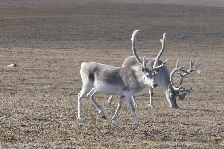
Peary caribou on Bathurst Island, Qausuittuq National Park.
CA-K1024Places & geography

Qausuittuq, “place where the sun doesn’t rise”

Qausuittuq, Inuktitut for “place where the sun doesn’t rise,” is a national park rich in natural and cultural heritage in Nunavut’s High Arctic. Managed jointly by Inuit and Parks Canada, it protects key habitat for Peary caribou.

Factual accuracy review: No recorded challenge

Contributor: Citizen.ca

Verified against cited sourcesVerified on 2026-10-27↗
Photo: Paul Gierszewski · Photo licence: CC BY-SA 4.0 · Credit & context
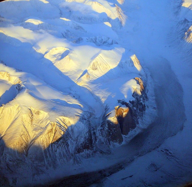
Akshayuk Pass, Auyuittuq National Park.
CA-K1023Places & geography

Auyuittuq, “the land that never melts”

Auyuittuq National Park, on southeastern Baffin Island in Nunavut, is named with the Inuktitut words for “the land that never melts.” The peaks of Akshayuk Pass overlook a natural corridor through sprawling glaciers, steep fiords and winding river valleys, in a landscape rich in Inuit culture and history.

Factual accuracy review: No recorded challenge

Contributor: Citizen.ca

Verified against cited sourcesVerified on 2026-10-27↗
Photo: Doc Searls from Santa Barbara, USA · Photo licence: CC BY 2.0 · Credit & context
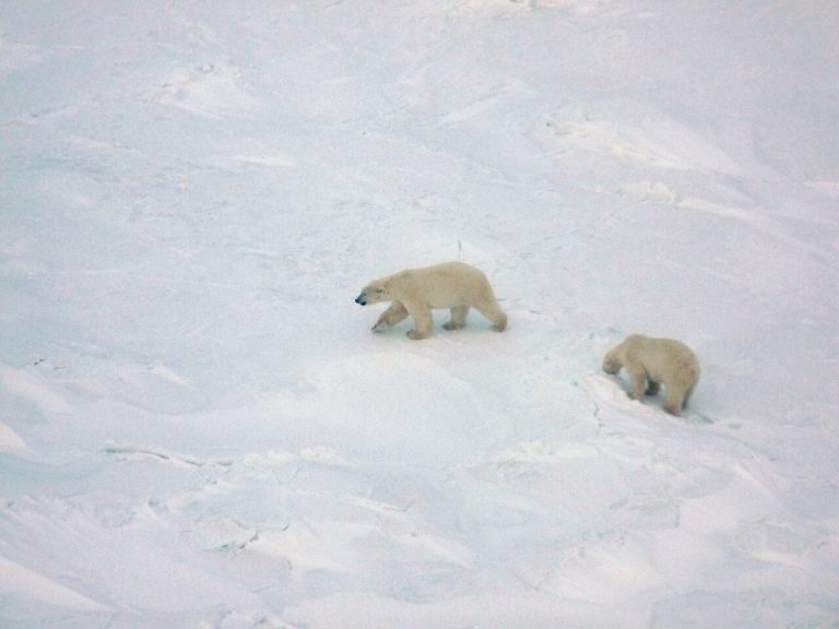
Polar bears in Wapusk National Park, seen from a helicopter.
CA-K1020Places & geography

Wapusk National Park and its polar bear dens

Wapusk National Park in northern Manitoba covers 11,475 square kilometres where boreal forest gives way to Arctic tundra, and protects one of the world’s largest polar bear maternity denning areas. It is on Treaty 5 territory and lands traditionally used by the Cree, Dene, Inuit and Red River Métis, and visits are made through licensed tour operators in Churchill.

Factual accuracy review: No recorded challenge

Contributor: Citizen.ca

Verified against cited sourcesVerified on 2026-10-27↗
Photo: Peterfitzgerald · Photo licence: CC BY-SA 3.0 · Credit & context
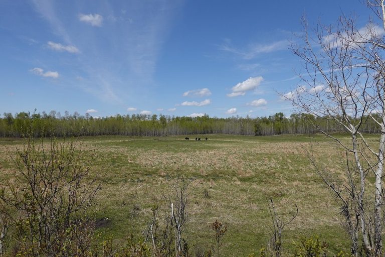
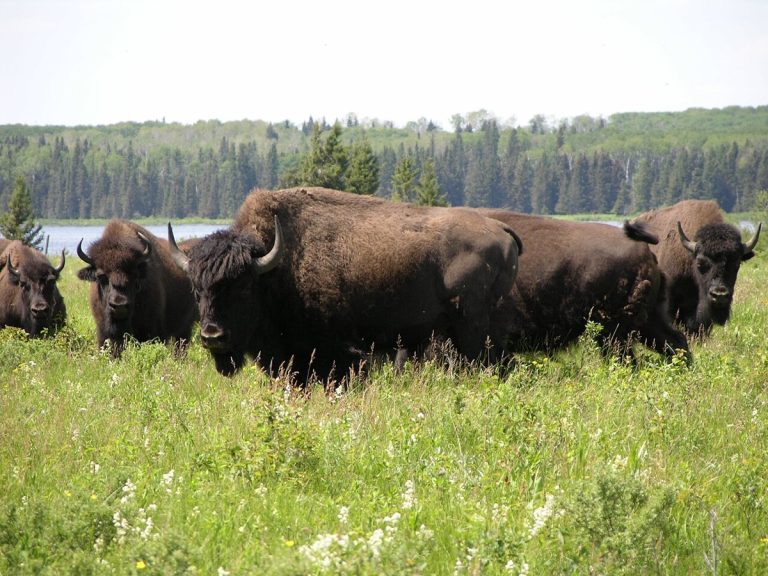
Bison herd at Lake Audy, Riding Mountain National Park.
CA-K1019Places & geography

Riding Mountain National Park in Manitoba

Riding Mountain National Park in Manitoba is home to a striking diversity of life: windswept grasslands and deep forests, wolf packs, orchids and lilies, and lakes and wetlands. The park is in Treaty 2 Territory, and Parks Canada works there with Anishinabe First Nations from Treaties 2, 4 and 1.

Factual accuracy review: No recorded challenge

Contributor: Citizen.ca

Verified against cited sourcesVerified on 2026-10-27↗
Photo: Norm Andreiw · Photo licence: CC BY 3.0 · Credit & context
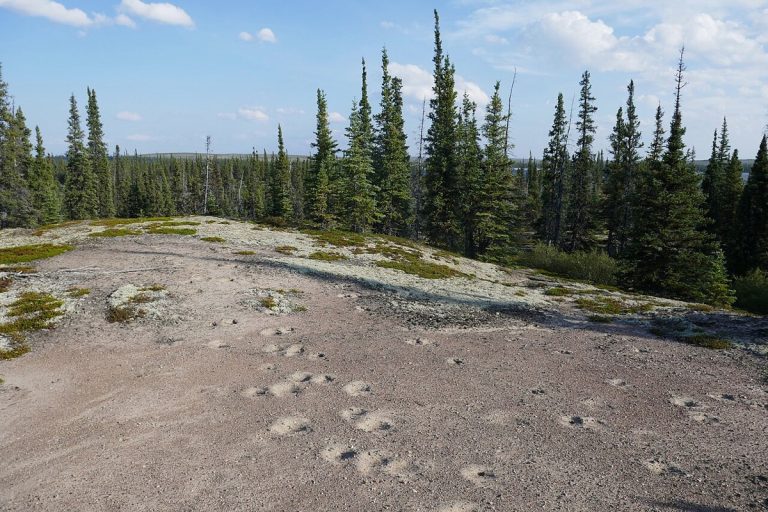
Muskox tracks on an esker, Thaıdene Nëné National Park Reserve.
CA-K1017Places & geography

Thaıdene Nëné, “The Land of the Ancestors”

Thaıdene Nëné, “The Land of the Ancestors” in Dënesųłiné Yati, is an Indigenous Protected Area of more than 26,000 square kilometres in the Northwest Territories, with Thaıdene Nëné National Park Reserve at its core. Here barrens and subarctic boreal forest meet on the shore of one of the world’s largest freshwater lakes. The park reserve is managed jointly with the Łutsël K’é Dene First Nation, the Northwest Territory Métis Nation, the Deninu Kųę First Nation and the Yellowknives Dene First Nation.

Factual accuracy review: No recorded challenge

Contributor: Citizen.ca

Verified against cited sourcesVerified on 2026-10-27↗
Photo: Paul Gierszewski · Photo licence: CC BY 4.0 · Credit & context
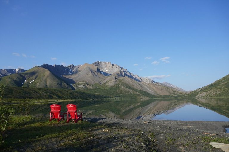
Nı́onep'ene Lake, Nááts'įhch'oh National Park Reserve.
CA-K1016Places & geography

Nááts’įhch’oh National Park Reserve

Nááts'įhch'oh National Park Reserve in the Northwest Territories is named for the mountain Nááts'įhch'oh, a powerful place for the people of the Sahtu. Near the Yukon border, in the traditional lands of the Shúhtaot'ine (Mountain Dene), it is home to grizzly bears, Dall’s sheep, mountain goats and woodland caribou.

Factual accuracy review: No recorded challenge

Contributor: Citizen.ca

Verified against cited sourcesVerified on 2026-10-27↗
Photo: Paul Gierszewski · Photo licence: CC BY-SA 4.0 · Credit & context
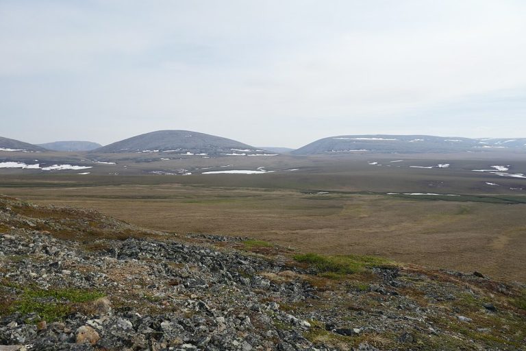
Tundra and distant hills in Vuntut National Park.
CA-K1014Places & geography

Vuntut National Park and the Vuntut Gwitchin

Vuntut National Park lies above the Arctic Circle in northern Yukon, a remote wilderness with a First Nations history going back millennia. It includes part of the Old Crow Flats, a vast wetland of shallow lakes and streams important to the Vuntut Gwitchin for hunting and traditional practices, and the range of the Porcupine caribou herd, which is central to Vuntut Gwitchin culture.

Factual accuracy review: No recorded challenge

Contributor: Citizen.ca

Verified against cited sourcesVerified on 2026-10-27↗
Photo: Paul Gierszewski · Photo licence: CC BY-SA 4.0 · Credit & context
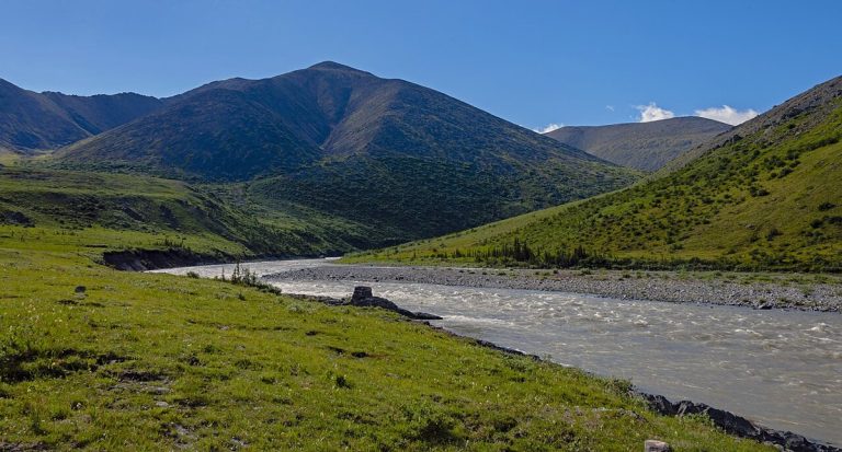
The Firth River, Ivvavik National Park.
CA-K1012Places & geography

Ivvavik, the first national park created by a land claim

Ivvavik National Park, in the far northwest of Yukon above the Arctic Circle, takes its name from the Inuvialuktun word for “a place for giving birth, a nursery.” It was the first national park in Canada created through an Indigenous land claim agreement, the Inuvialuit Final Agreement of 1984, and it protects part of the calving grounds of the Porcupine caribou herd.

Factual accuracy review: No recorded challenge

Contributor: Citizen.ca

Verified against cited sourcesVerified on 2026-10-27↗
Photo: Daniel Case · Photo licence: CC BY-SA 3.0 · Credit & context
Forest vegetation in the Long Beach area of Pacific Rim National Park Reserve.
CA-K1009Places & geography

Pacific Rim National Park Reserve on Vancouver Island

Pacific Rim National Park Reserve lies along the west coast of Vancouver Island, in the traditional territories of the Nuu-chah-nulth First Nations. It offers kilometres of long sandy beaches and temperate rainforest, and includes the Long Beach area, the Broken Group Islands and the West Coast Trail.

Factual accuracy review: No recorded challenge

Contributor: Citizen.ca

Verified against cited sourcesVerified on 2026-10-27↗
Photo: EcaterinaLitvin · Photo licence: CC BY-SA 4.0 · Credit & context
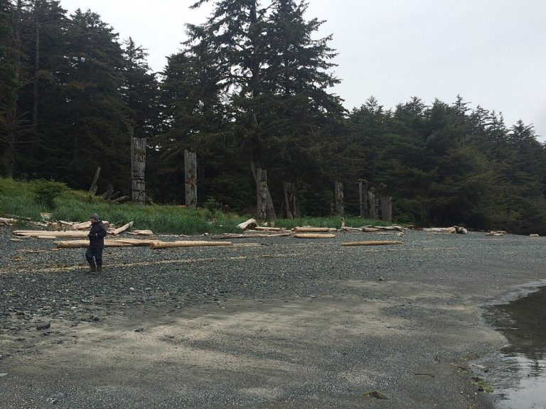
Gwaii Haanas, Haida Gwaii.
CA-K1007Places & geography

Gwaii Haanas, Haida land and sea

On the rainforest islands of Gwaii Haanas, in Haida Gwaii, moss-draped cedar and Sitka spruce tower over the Haida people’s historic carved poles and fallen longhouses. Bald eagles, bears, whales, porpoises and sea lions live here. The land and sea are protected by Parks Canada, Fisheries and Oceans Canada and the Haida, and Haida Gwaii Watchmen share Haida culture at five village sites.

Factual accuracy review: No recorded challenge

Contributor: Citizen.ca

Verified against cited sourcesVerified on 2026-10-27↗
Photo: Christine Rondeau from Vancouver, Canada · Photo licence: CC BY 2.0 · Credit & context
A grassland landscape in Elk Island National Park.
CA-K1002Places & geography

Elk Island National Park, near Edmonton

Elk Island National Park lies about 48 kilometres east of downtown Edmonton, in Treaty 6 territory and the Métis homeland. Its rolling hills, lakes and dark skies form a landscape Indigenous Peoples have long used for sustenance, ceremony, trade and travel. The park supports bison, elk and more than 250 bird species.

Factual accuracy review: No recorded challenge

Contributor: Citizen.ca

Verified against cited sourcesVerified on 2026-10-27↗
Photo: Khoshhat · Photo licence: CC0 · Credit & context
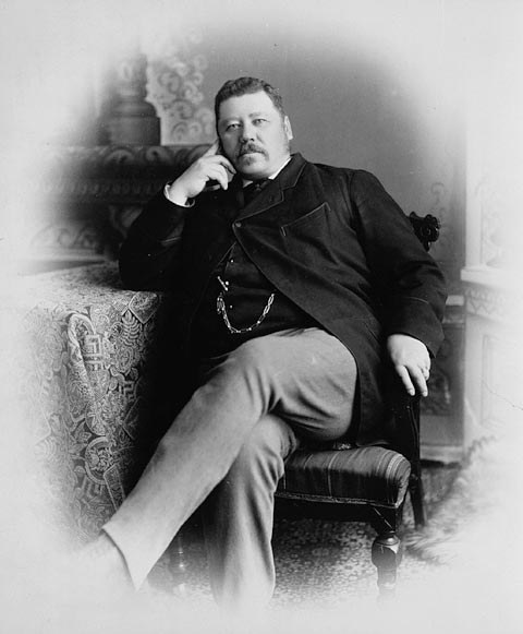
John Norquay, Premier of Manitoba, about 1878.
CA-K1000History

John Norquay, Métis premier of Manitoba

John Norquay, a Métis statesman born at St. Andrew’s in the Red River settlement, was elected to Manitoba’s first assembly in 1870 and became premier in 1878. His government, built on shared French and English participation, won an extended Manitoba boundary and better financial terms from Ottawa, and built railways in defiance of the Canadian Pacific charter and federal disallowance. He resigned as premier in 1887 but sat as a member until his death.

Factual accuracy review: No recorded challenge

Contributor: Citizen.ca

Verified against cited sourcesVerified on 2026-10-27↗
Photo: Unknown author · Photo licence: Public domain · Credit & context
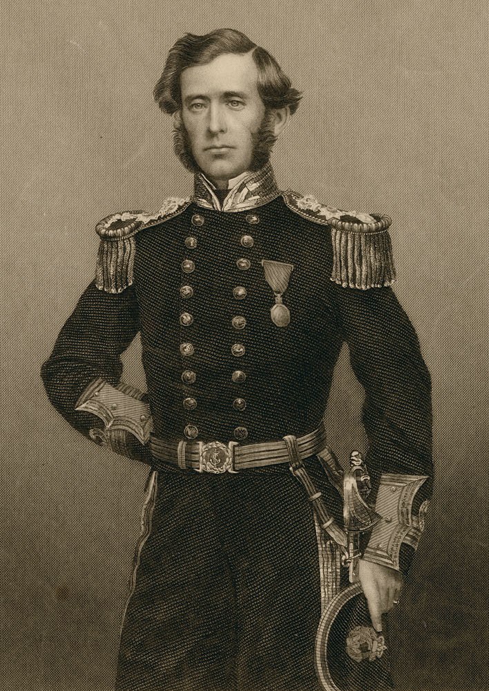
Captain Sir Leopold McClintock, about 1860.
CA-K960Places & geography

Sir Leopold McClintock and the fate of Franklin

Leopold McClintock sailed as a young lieutenant on the Franklin search expeditions of 1848 and 1850, proving an intrepid sled traveller on Somerset and Melville islands. In 1857 Lady Franklin sent him in the Fox to check the reports of Franklin’s death that Dr. John Rae had received from Inuit. In spring 1859 he found written evidence of Franklin’s fate on the shore of King William Island.

Factual accuracy review: No recorded challenge

Contributor: Citizen.ca

Verified against cited sourcesVerified on 2026-10-27↗
Photo: John Powles Cheyne · Photo licence: Public domain · Credit & context
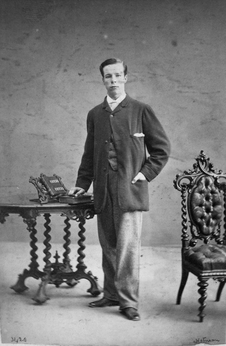
David Ross McCord, 1862 (William Notman).
CA-K932Institutions

David Ross McCord, collector and museum founder

David Ross McCord, of a prominent Montréal family, built one of the earliest and most important collections of objects, images and manuscripts on Canada’s history. Believing that knowing the past strengthens national identity, he spent most of his life and fortune gathering some 15,000 items on Indigenous, French and British history in North America, and left them to McGill University, which founded the museum he had dreamed of.

Factual accuracy review: No recorded challenge

Contributor: Citizen.ca

Verified against cited sourcesVerified on 2026-10-27↗
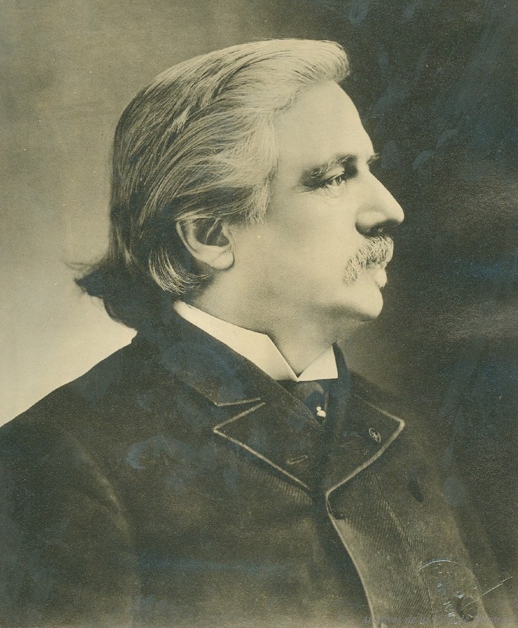
Photo: William Notman · Photo licence: Public domain · Credit & context
Joseph-Adolphe Chapleau, about 1890.
CA-K914History

Sir Adolphe Chapleau, premier of Quebec

Joseph-Adolphe Chapleau, born at Sainte-Thérèse-de-Blainville, was one of 19th-century Quebec’s most prominent figures. A noted criminal lawyer who supported Métis rights, he defended Ambroise-Dydime Lépine at his 1874 trial at Fort Garry. He was premier of Quebec (1879–82), a federal cabinet minister (1882–92) and Lieutenant Governor of Quebec (1892–97), and spoke for Montréal during a key period of its growth.

Factual accuracy review: No recorded challenge

Contributor: Citizen.ca

Verified against cited sourcesVerified on 2026-10-27↗
Photo: Aegidius Fauteux · Photo licence: Public domain · Credit & context
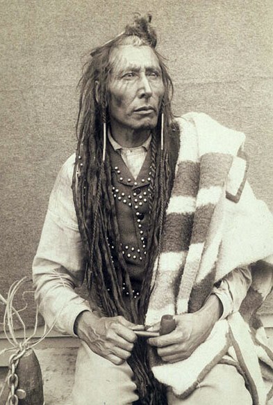
Pitikwahanapiwiyin (Poundmaker), 1885 (O.B. Buell).
CA-K887Indigenous peoples & reconciliation

Pitikwahanapiwiyin (Poundmaker), nehiyaw chief

Pitikwahanapiwiyin (Poundmaker), a nehiyaw (Plains Cree) chief and spokesman, sought better terms for his people and pressed Canada to honour Treaty 6. In 1885 he was drawn into the North-West Resistance when Lieutenant-Colonel Otter’s troops attacked his peaceful camp near Cut Knife Hill. Though he worked to prevent bloodshed and surrendered on May 26, he was imprisoned; he died soon after release and was exonerated in 2019.

Factual accuracy review: No recorded challenge

Contributor: Citizen.ca

Verified against cited sourcesVerified on 2026-10-26↗
Photo: Prof. Buell, O.B. · Photo licence: Public domain · Credit & context
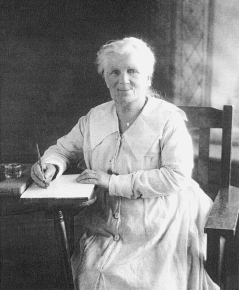
Susan Louisa Moir Allison, portrait.
CA-K876Culture & sport

Susan Allison, memoirist of the BC interior

Susan Allison wrote a memoir of settler life in the interior of British Columbia, describing the experiences of women, children and Indigenous people. As an amateur ethnographer, she also recorded Similkameen and Okanagan stories. Her writings are historical sources that should be read in the context of European settlement and colonial relations.

Factual accuracy review: No recorded challenge

Contributor: Citizen.ca

Verified against cited sourcesVerified on 2026-10-26↗
Photo: Unknown author · Photo licence: Public domain · Credit & context
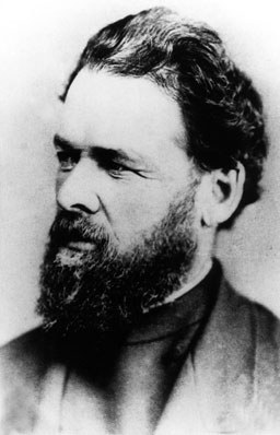
Reverend George McDougall, before 1876.
CA-K867Indigenous peoples & reconciliation

Reverend George McDougall and Methodist missions in the West

George McDougall was an influential Methodist missionary in the Prairie West from 1860 until his death in 1876, founding the Victoria mission in 1862 and leading others as part of colonization efforts. He urged First Nations to abandon traditional ways, removed the sacred stone Manitou Asinîy in 1866 with damaging results, and carried word of the coming Treaty Six talks in 1875. Missions linked to him at Norway House and Morley later developed residential schools.

Factual accuracy review: No recorded challenge

Contributor: Citizen.ca

Verified against cited sourcesVerified on 2026-10-26↗
Photo: Unknown author · Photo licence: Public domain · Credit & context