An independent Canadian knowledge project

Focused and Verified

Canadian knowledge base

Search by keyword

Choose one keyword, or combine two. Broader keywords include their descendants.

Keywords: Peoples and communities

Clear search
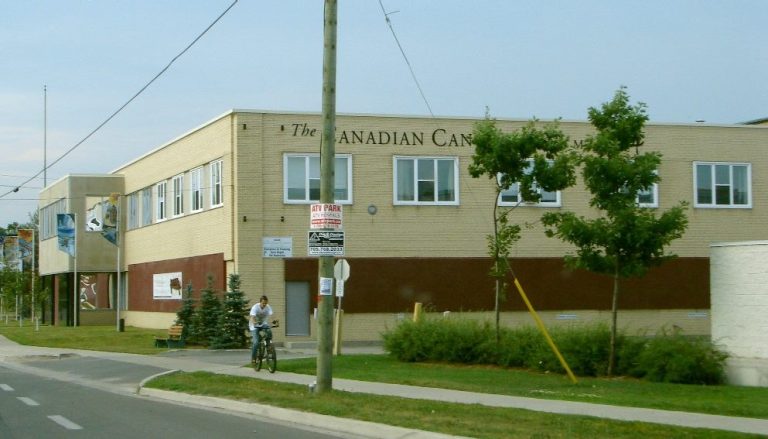
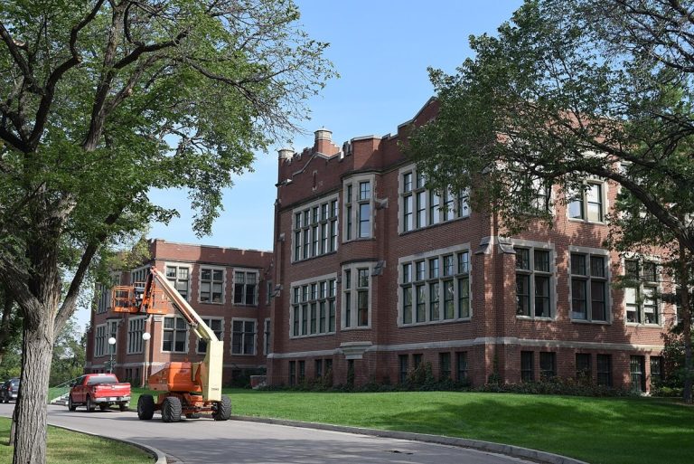
University of Regina Continuing Development Centre.
CA-K1152Institutions

University of Regina, independent since 1974

The University of Regina became an independent, degree-granting university on July 1, 1974, building on its earlier history as Regina College. Its federated colleges include Campion College, Luther College and First Nations University of Canada.

Factual accuracy review: No recorded challenge

Contributor: Citizen.ca

Verified against cited sourcesVerified on 2026-10-27↗
Photo: Haydn Blackey from Cardiff, Wales · Photo licence: CC BY-SA 2.0 · Credit & context
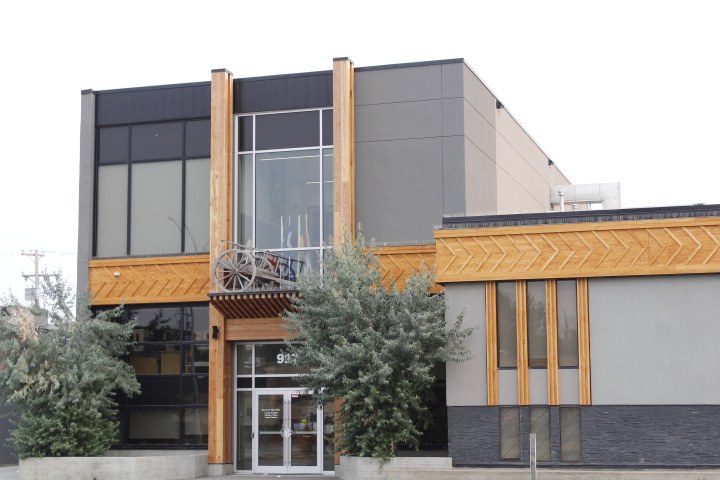
Gabriel Dumont Institute, Saskatoon.
CA-K1148Institutions

Gabriel Dumont Institute, the education arm of the Métis Nation – Saskatchewan

The Gabriel Dumont Institute of Native Studies and Applied Research was founded in 1980 to meet the educational and cultural needs of Saskatchewan’s Métis community. It is the official training and education arm of the Métis Nation – Saskatchewan and is owned by the Métis people of Saskatchewan; its college delivers the first two years of University of Saskatchewan arts and science degrees.

Factual accuracy review: No recorded challenge

Contributor: Citizen.ca

Verified against cited sourcesVerified on 2026-10-27↗
Photo: Tanbir M-05 · Photo licence: CC BY-SA 4.0 · Credit & context
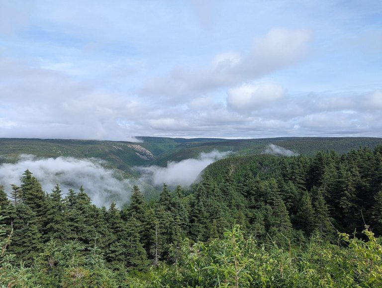
Cape Breton Highlands National Park from the Cabot Trail.
CA-K1041Places & geography

Cape Breton Highlands National Park and the Cabot Trail

Cape Breton Highlands National Park in Nova Scotia protects a forested plateau cut by steep cliffs and deep river canyons along the Atlantic coast. About one-third of the Cabot Trail runs through the park. Its cool maritime climate and rugged landscape bring together Acadian, boreal and taiga habitats.

Factual accuracy review: No recorded challenge

Contributor: Citizen.ca

Verified against cited sourcesVerified on 2026-10-27↗
Photo: ArcaneCraeda · Photo licence: CC BY-SA 4.0 · Credit & context
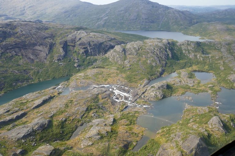
An aerial view of the Mealy Mountains in Labrador.
CA-K1039Places & geography

Akami-Uapishkᵁ-KakKasuak-Mealy Mountains, eastern Canada’s largest national park

Akami-Uapishkᵁ-KakKasuak-Mealy Mountains National Park Reserve in Labrador covers 10,700 square kilometres and is the largest national park in eastern Canada. Its Innu and Labrador Inuit names refer to white mountains and a mountain. The bare, glacier-rounded summits of the Mealy Mountains rise 1,180 metres above Lake Melville.

Factual accuracy review: No recorded challenge

Contributor: Citizen.ca

Verified against cited sourcesVerified on 2026-10-27↗
Photo: Paul Gierszewski · Photo licence: CC BY-SA 4.0 · Credit & context
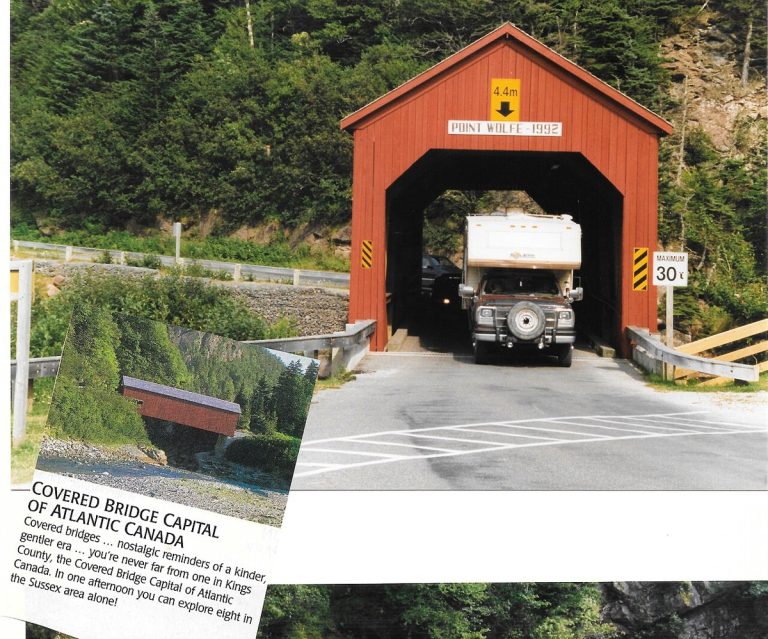
The Point Wolfe covered bridge in Fundy National Park, with an inset showing a photographed interpretive sign.
CA-K1037Places & geography

Fundy National Park, from tides to Acadian forest

Fundy National Park in New Brunswick lies on the Bay of Fundy, home of the world’s highest tides, on the unceded territory of the Mi’gmaq. Beyond the shore, where visitors can walk the sea floor at low tide, trails lead inland to waterfalls deep in Acadian forest, and the park works with partners to recover Inner Bay of Fundy Atlantic salmon.

Factual accuracy review: No recorded challenge

Contributor: Citizen.ca

Verified against cited sourcesVerified on 2026-10-27↗
Photo: Eduard47 · Photo licence: CC BY-SA 4.0 · Credit & context
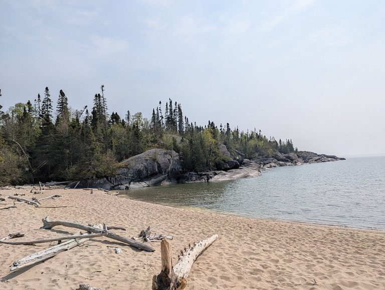
Horseshoe Bay beach, Pukaskwa National Park.
CA-K1032Places & geography

Pukaskwa National Park on Lake Superior

Pukaskwa National Park protects a remote granite shore of Lake Superior in Ontario, with windswept spruce and pine, towering cliffs and secluded sandy beaches. Black bears, loons and moose live here, and the culture of the Anishinaabe First Nations links the park’s wilderness to an ancient human story.

Factual accuracy review: No recorded challenge

Contributor: Citizen.ca

Verified against cited sourcesVerified on 2026-10-27↗
Photo: Hirgax · Photo licence: CC BY-SA 4.0 · Credit & context
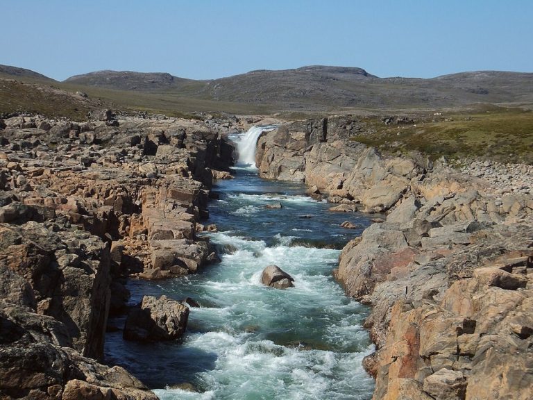
Upper Sila River Falls, Ukkusiksalik National Park.
CA-K1027Places & geography

Ukkusiksalik National Park on Wager Bay

Ukkusiksalik National Park lies along the shores of Wager Bay in Nunavut, a rolling tundra full of wildlife. Polar bears, Arctic wolves and caribou roam a landscape where hundreds of archaeological sites tell the story of Inuit who have lived and travelled here for thousands of years.

Factual accuracy review: No recorded challenge

Contributor: Citizen.ca

Verified against cited sourcesVerified on 2026-10-27↗
Photo: Paul Gierszewski (Gierszep) · Photo licence: CC BY-SA 4.0 · Credit & context
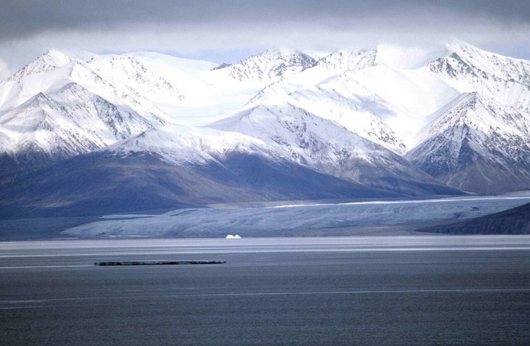
Sirmilik Glacier, Bylot Island.
CA-K1026Places & geography

Sirmilik National Park, Bylot Island and the Borden Peninsula

Sirmilik National Park in Nunavut is a landscape of glaciers, valleys and red-rock hoodoos. Nesting seabirds crowd the cliffs of Bylot Island above icy waters full of narwhal and beluga whales, and the area’s rich wildlife has sustained Inuit for thousands of years.

Factual accuracy review: No recorded challenge

Contributor: Citizen.ca

Verified against cited sourcesVerified on 2026-10-27↗
Photo: Ansgar Walk · Photo licence: CC BY-SA 2.5 · Credit & context
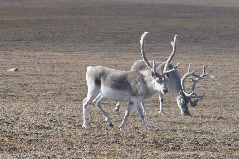
Peary caribou on Bathurst Island, Qausuittuq National Park.
CA-K1024Places & geography

Qausuittuq, “place where the sun doesn’t rise”

Qausuittuq, Inuktitut for “place where the sun doesn’t rise,” is a national park rich in natural and cultural heritage in Nunavut’s High Arctic. Managed jointly by Inuit and Parks Canada, it protects key habitat for Peary caribou.

Factual accuracy review: No recorded challenge

Contributor: Citizen.ca

Verified against cited sourcesVerified on 2026-10-27↗
Photo: Paul Gierszewski · Photo licence: CC BY-SA 4.0 · Credit & context
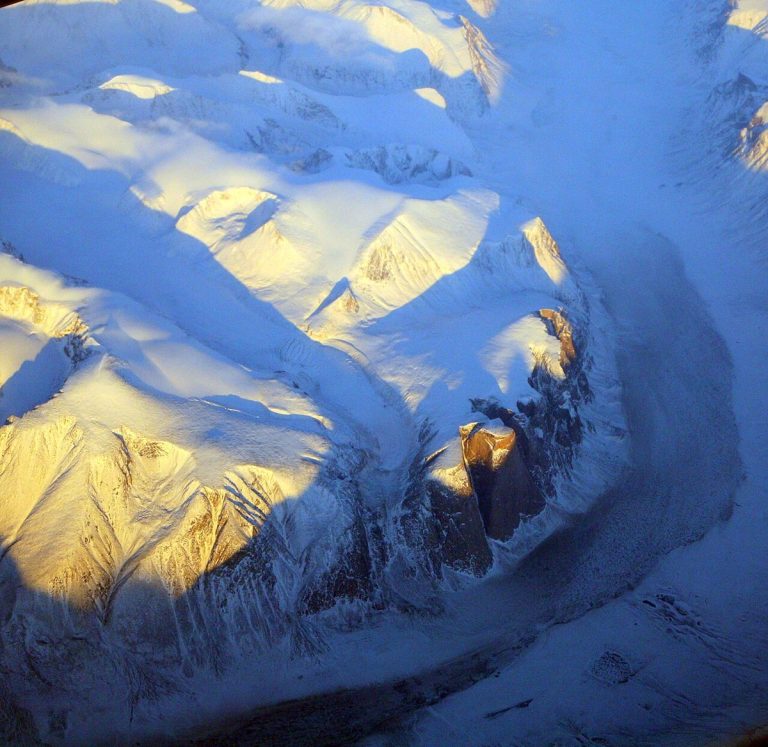
Akshayuk Pass, Auyuittuq National Park.
CA-K1023Places & geography

Auyuittuq, “the land that never melts”

Auyuittuq National Park, on southeastern Baffin Island in Nunavut, is named with the Inuktitut words for “the land that never melts.” The peaks of Akshayuk Pass overlook a natural corridor through sprawling glaciers, steep fiords and winding river valleys, in a landscape rich in Inuit culture and history.

Factual accuracy review: No recorded challenge

Contributor: Citizen.ca

Verified against cited sourcesVerified on 2026-10-27↗
Photo: Doc Searls from Santa Barbara, USA · Photo licence: CC BY 2.0 · Credit & context
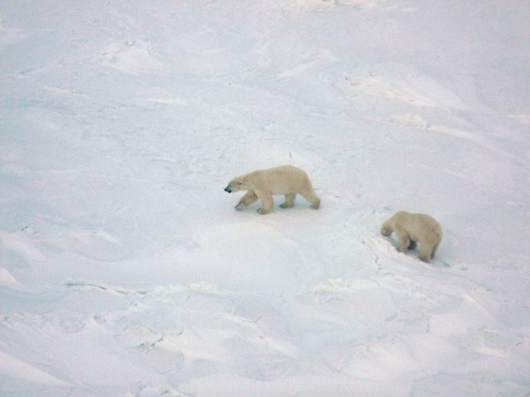
Polar bears in Wapusk National Park, seen from a helicopter.
CA-K1020Places & geography

Wapusk National Park and its polar bear dens

Wapusk National Park in northern Manitoba covers 11,475 square kilometres where boreal forest gives way to Arctic tundra, and protects one of the world’s largest polar bear maternity denning areas. It is on Treaty 5 territory and lands traditionally used by the Cree, Dene, Inuit and Red River Métis, and visits are made through licensed tour operators in Churchill.

Factual accuracy review: No recorded challenge

Contributor: Citizen.ca

Verified against cited sourcesVerified on 2026-10-27↗
Photo: Peterfitzgerald · Photo licence: CC BY-SA 3.0 · Credit & context
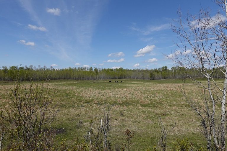
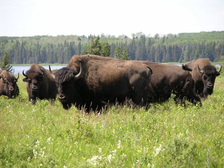
Bison herd at Lake Audy, Riding Mountain National Park.
CA-K1019Places & geography

Riding Mountain National Park in Manitoba

Riding Mountain National Park in Manitoba is home to a striking diversity of life: windswept grasslands and deep forests, wolf packs, orchids and lilies, and lakes and wetlands. The park is in Treaty 2 Territory, and Parks Canada works there with Anishinabe First Nations from Treaties 2, 4 and 1.

Factual accuracy review: No recorded challenge

Contributor: Citizen.ca

Verified against cited sourcesVerified on 2026-10-27↗
Photo: Norm Andreiw · Photo licence: CC BY 3.0 · Credit & context
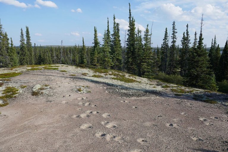
Muskox tracks on an esker, Thaıdene Nëné National Park Reserve.
CA-K1017Places & geography

Thaıdene Nëné, “The Land of the Ancestors”

Thaıdene Nëné, “The Land of the Ancestors” in Dënesųłiné Yati, is an Indigenous Protected Area of more than 26,000 square kilometres in the Northwest Territories, with Thaıdene Nëné National Park Reserve at its core. Here barrens and subarctic boreal forest meet on the shore of one of the world’s largest freshwater lakes. The park reserve is managed jointly with the Łutsël K’é Dene First Nation, the Northwest Territory Métis Nation, the Deninu Kųę First Nation and the Yellowknives Dene First Nation.

Factual accuracy review: No recorded challenge

Contributor: Citizen.ca

Verified against cited sourcesVerified on 2026-10-27↗
Photo: Paul Gierszewski · Photo licence: CC BY 4.0 · Credit & context
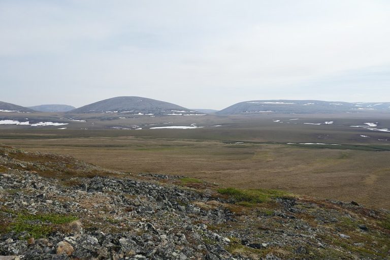
Tundra and distant hills in Vuntut National Park.
CA-K1014Places & geography

Vuntut National Park and the Vuntut Gwitchin

Vuntut National Park lies above the Arctic Circle in northern Yukon, a remote wilderness with a First Nations history going back millennia. It includes part of the Old Crow Flats, a vast wetland of shallow lakes and streams important to the Vuntut Gwitchin for hunting and traditional practices, and the range of the Porcupine caribou herd, which is central to Vuntut Gwitchin culture.

Factual accuracy review: No recorded challenge

Contributor: Citizen.ca

Verified against cited sourcesVerified on 2026-10-27↗
Photo: Paul Gierszewski · Photo licence: CC BY-SA 4.0 · Credit & context
Forest vegetation in the Long Beach area of Pacific Rim National Park Reserve.
CA-K1009Places & geography

Pacific Rim National Park Reserve on Vancouver Island

Pacific Rim National Park Reserve lies along the west coast of Vancouver Island, in the traditional territories of the Nuu-chah-nulth First Nations. It offers kilometres of long sandy beaches and temperate rainforest, and includes the Long Beach area, the Broken Group Islands and the West Coast Trail.

Factual accuracy review: No recorded challenge

Contributor: Citizen.ca

Verified against cited sourcesVerified on 2026-10-27↗
Photo: EcaterinaLitvin · Photo licence: CC BY-SA 4.0 · Credit & context
A grassland landscape in Elk Island National Park.
CA-K1002Places & geography

Elk Island National Park, near Edmonton

Elk Island National Park lies about 48 kilometres east of downtown Edmonton, in Treaty 6 territory and the Métis homeland. Its rolling hills, lakes and dark skies form a landscape Indigenous Peoples have long used for sustenance, ceremony, trade and travel. The park supports bison, elk and more than 250 bird species.

Factual accuracy review: No recorded challenge

Contributor: Citizen.ca

Verified against cited sourcesVerified on 2026-10-27↗
Photo: Khoshhat · Photo licence: CC0 · Credit & context
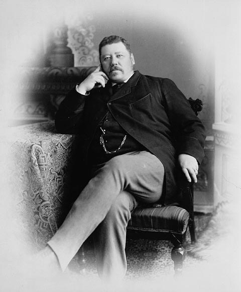
John Norquay, Premier of Manitoba, about 1878.
CA-K1000History

John Norquay, Métis premier of Manitoba

John Norquay, a Métis statesman born at St. Andrew’s in the Red River settlement, was elected to Manitoba’s first assembly in 1870 and became premier in 1878. His government, built on shared French and English participation, won an extended Manitoba boundary and better financial terms from Ottawa, and built railways in defiance of the Canadian Pacific charter and federal disallowance. He resigned as premier in 1887 but sat as a member until his death.

Factual accuracy review: No recorded challenge

Contributor: Citizen.ca

Verified against cited sourcesVerified on 2026-10-27↗
Photo: Unknown author · Photo licence: Public domain · Credit & context
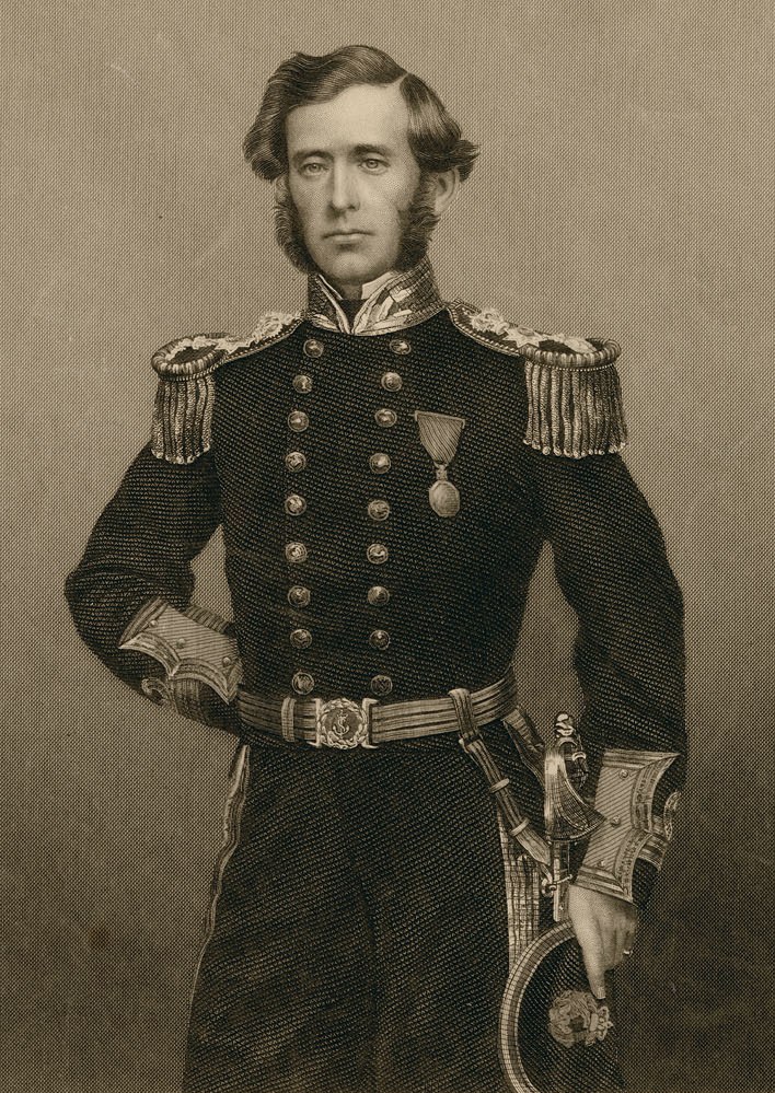
Captain Sir Leopold McClintock, about 1860.
CA-K960Places & geography

Sir Leopold McClintock and the fate of Franklin

Leopold McClintock sailed as a young lieutenant on the Franklin search expeditions of 1848 and 1850, proving an intrepid sled traveller on Somerset and Melville islands. In 1857 Lady Franklin sent him in the Fox to check the reports of Franklin’s death that Dr. John Rae had received from Inuit. In spring 1859 he found written evidence of Franklin’s fate on the shore of King William Island.

Factual accuracy review: No recorded challenge

Contributor: Citizen.ca

Verified against cited sourcesVerified on 2026-10-27↗
Photo: John Powles Cheyne · Photo licence: Public domain · Credit & context