An independent Canadian knowledge project

Focused and Verified

Canadian knowledge base

Search by keyword

Choose one keyword, or combine two. Broader keywords include their descendants.

Keywords: Places & geography

Clear search
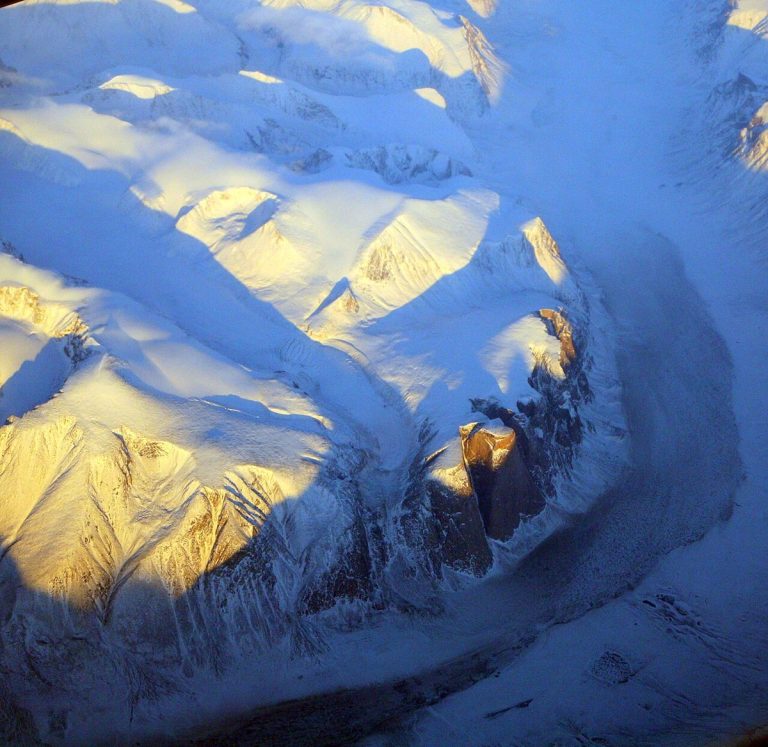
Akshayuk Pass, Auyuittuq National Park.
CA-K1023Places & geography

Auyuittuq, “the land that never melts”

Auyuittuq National Park, on southeastern Baffin Island in Nunavut, is named with the Inuktitut words for “the land that never melts.” The peaks of Akshayuk Pass overlook a natural corridor through sprawling glaciers, steep fiords and winding river valleys, in a landscape rich in Inuit culture and history.

Factual accuracy review: No recorded challenge

Contributor: Citizen.ca

Verified against cited sourcesVerified on 2026-10-27↗
Photo: Doc Searls from Santa Barbara, USA · Photo licence: CC BY 2.0 · Credit & context
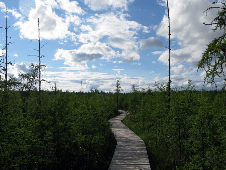
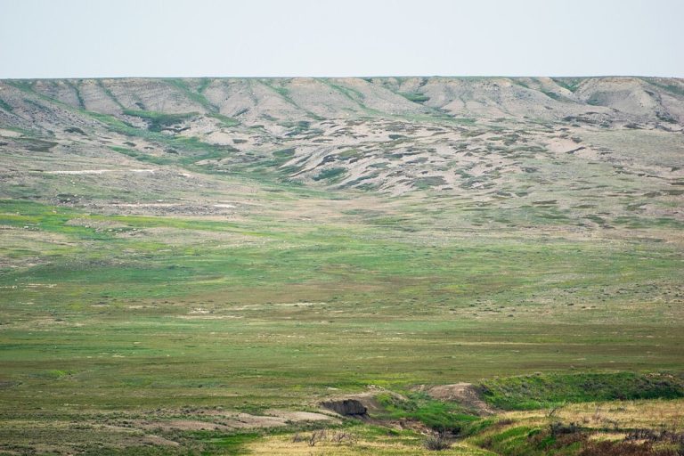
Grasslands National Park, Saskatchewan.
CA-K1021Places & geography

Grasslands National Park’s living prairie

Grasslands National Park protects a stretch of southern Saskatchewan prairie. Among today’s living prairie lie traces of the deep past and of those who came before: dinosaur fossils, the mass extinction boundary, hearth sites, tipi rings, bison drive lanes and the cellar depressions of homesteads.

Factual accuracy review: No recorded challenge

Contributor: Citizen.ca

Verified against cited sourcesVerified on 2026-10-27↗
Photo: Claude Charbonneau · Photo licence: CC BY-SA 4.0 · Credit & context
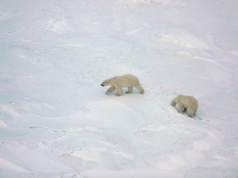
Polar bears in Wapusk National Park, seen from a helicopter.
CA-K1020Places & geography

Wapusk National Park and its polar bear dens

Wapusk National Park in northern Manitoba covers 11,475 square kilometres where boreal forest gives way to Arctic tundra, and protects one of the world’s largest polar bear maternity denning areas. It is on Treaty 5 territory and lands traditionally used by the Cree, Dene, Inuit and Red River Métis, and visits are made through licensed tour operators in Churchill.

Factual accuracy review: No recorded challenge

Contributor: Citizen.ca

Verified against cited sourcesVerified on 2026-10-27↗
Photo: Peterfitzgerald · Photo licence: CC BY-SA 3.0 · Credit & context
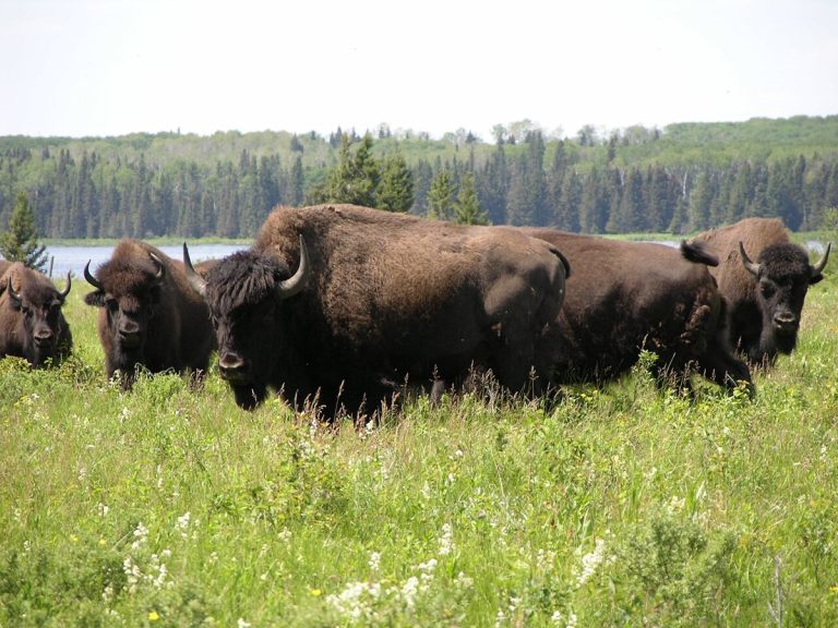
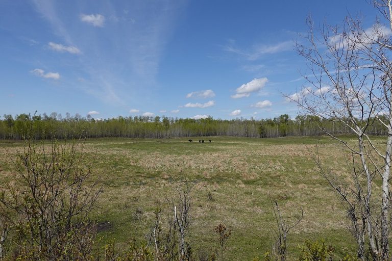
Bison herd at Lake Audy, Riding Mountain National Park.
CA-K1019Places & geography

Riding Mountain National Park in Manitoba

Riding Mountain National Park in Manitoba is home to a striking diversity of life: windswept grasslands and deep forests, wolf packs, orchids and lilies, and lakes and wetlands. The park is in Treaty 2 Territory, and Parks Canada works there with Anishinabe First Nations from Treaties 2, 4 and 1.

Factual accuracy review: No recorded challenge

Contributor: Citizen.ca

Verified against cited sourcesVerified on 2026-10-27↗
Photo: Norm Andreiw · Photo licence: CC BY 3.0 · Credit & context
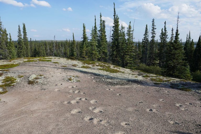
Muskox tracks on an esker, Thaıdene Nëné National Park Reserve.
CA-K1017Places & geography

Thaıdene Nëné, “The Land of the Ancestors”

Thaıdene Nëné, “The Land of the Ancestors” in Dënesųłiné Yati, is an Indigenous Protected Area of more than 26,000 square kilometres in the Northwest Territories, with Thaıdene Nëné National Park Reserve at its core. Here barrens and subarctic boreal forest meet on the shore of one of the world’s largest freshwater lakes. The park reserve is managed jointly with the Łutsël K’é Dene First Nation, the Northwest Territory Métis Nation, the Deninu Kųę First Nation and the Yellowknives Dene First Nation.

Factual accuracy review: No recorded challenge

Contributor: Citizen.ca

Verified against cited sourcesVerified on 2026-10-27↗
Photo: Paul Gierszewski · Photo licence: CC BY 4.0 · Credit & context
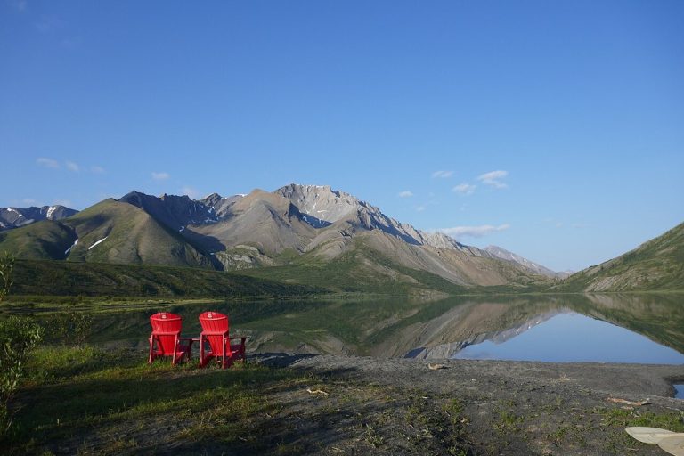
Nı́onep'ene Lake, Nááts'įhch'oh National Park Reserve.
CA-K1016Places & geography

Nááts’įhch’oh National Park Reserve

Nááts'įhch'oh National Park Reserve in the Northwest Territories is named for the mountain Nááts'įhch'oh, a powerful place for the people of the Sahtu. Near the Yukon border, in the traditional lands of the Shúhtaot'ine (Mountain Dene), it is home to grizzly bears, Dall’s sheep, mountain goats and woodland caribou.

Factual accuracy review: No recorded challenge

Contributor: Citizen.ca

Verified against cited sourcesVerified on 2026-10-27↗
Photo: Paul Gierszewski · Photo licence: CC BY-SA 4.0 · Credit & context
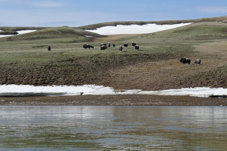
Muskoxen beside the Thomsen River, Aulavik National Park.
CA-K1015Places & geography

Aulavik National Park on Banks Island

Aulavik, meaning “place where people travel” in Inuvialuktun, protects more than 12,000 square kilometres of Arctic lowlands on northern Banks Island in the Northwest Territories. Its landscapes range from fertile river valleys to polar deserts, badlands, rolling hills and seacoasts.

Factual accuracy review: No recorded challenge

Contributor: Citizen.ca

Verified against cited sourcesVerified on 2026-10-27↗
Photo: Paul Gierszewski · Photo licence: CC BY-SA 4.0 · Credit & context
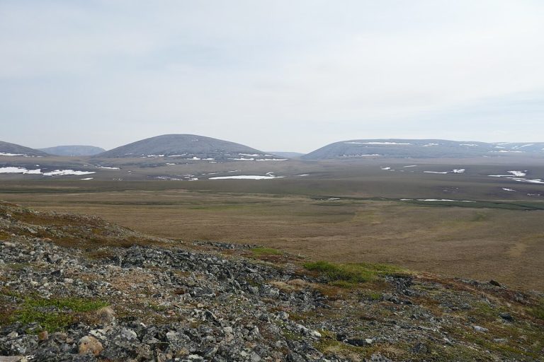
Tundra and distant hills in Vuntut National Park.
CA-K1014Places & geography

Vuntut National Park and the Vuntut Gwitchin

Vuntut National Park lies above the Arctic Circle in northern Yukon, a remote wilderness with a First Nations history going back millennia. It includes part of the Old Crow Flats, a vast wetland of shallow lakes and streams important to the Vuntut Gwitchin for hunting and traditional practices, and the range of the Porcupine caribou herd, which is central to Vuntut Gwitchin culture.

Factual accuracy review: No recorded challenge

Contributor: Citizen.ca

Verified against cited sourcesVerified on 2026-10-27↗
Photo: Paul Gierszewski · Photo licence: CC BY-SA 4.0 · Credit & context
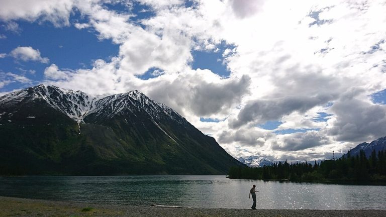
Kathleen Lake, Kluane National Park and Reserve.
CA-K1013Places & geography

Kluane National Park and Reserve in southwest Yukon

Kluane National Park and Reserve protects a landscape of high mountain peaks and massive valley glaciers in southwest Yukon, along with boreal forests, lakes such as Kathleen Lake, northern wildlife and Southern Tutchone cultural heritage.

Factual accuracy review: No recorded challenge

Contributor: Citizen.ca

Verified against cited sourcesVerified on 2026-10-27↗
Photo: Monacro · Photo licence: CC BY-SA 4.0 · Credit & context
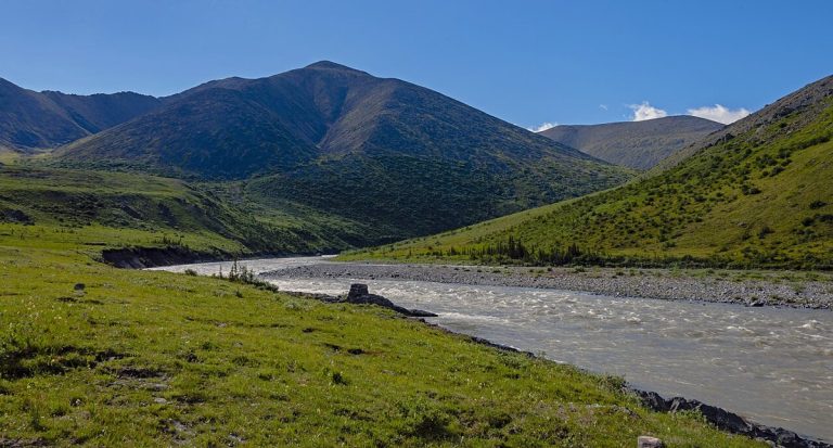
The Firth River, Ivvavik National Park.
CA-K1012Places & geography

Ivvavik, the first national park created by a land claim

Ivvavik National Park, in the far northwest of Yukon above the Arctic Circle, takes its name from the Inuvialuktun word for “a place for giving birth, a nursery.” It was the first national park in Canada created through an Indigenous land claim agreement, the Inuvialuit Final Agreement of 1984, and it protects part of the calving grounds of the Porcupine caribou herd.

Factual accuracy review: No recorded challenge

Contributor: Citizen.ca

Verified against cited sourcesVerified on 2026-10-27↗
Photo: Daniel Case · Photo licence: CC BY-SA 3.0 · Credit & context
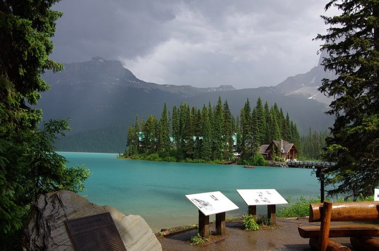
Emerald Lake, Yoho National Park.
CA-K1011Places & geography

Yoho National Park and the Burgess Shale

Yoho National Park in British Columbia lies on the western slopes of the Great Divide, where glaciers and waterfalls cling to towering peaks. The park protects Burgess Shale fossil sites, which reveal ancient marine life, in a landscape shaped by water.

Factual accuracy review: No recorded challenge

Contributor: Citizen.ca

Verified against cited sourcesVerified on 2026-10-27↗
Photo: Soumya.deo · Photo licence: CC BY-SA 4.0 · Credit & context
Forest vegetation in the Long Beach area of Pacific Rim National Park Reserve.
CA-K1009Places & geography

Pacific Rim National Park Reserve on Vancouver Island

Pacific Rim National Park Reserve lies along the west coast of Vancouver Island, in the traditional territories of the Nuu-chah-nulth First Nations. It offers kilometres of long sandy beaches and temperate rainforest, and includes the Long Beach area, the Broken Group Islands and the West Coast Trail.

Factual accuracy review: No recorded challenge

Contributor: Citizen.ca

Verified against cited sourcesVerified on 2026-10-27↗
Photo: EcaterinaLitvin · Photo licence: CC BY-SA 4.0 · Credit & context
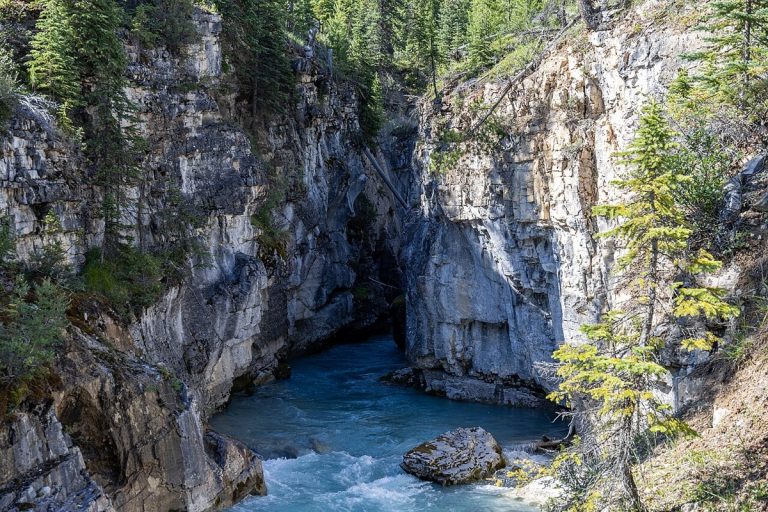
Marble Canyon, Kootenay National Park.
CA-K1008Places & geography

Kootenay National Park, a land of ice and fire

Kootenay National Park in British Columbia is a place of contrasts, with valleys and canyons carved by glaciers and grasslands shaped by fire. A historic highway crosses the park, and visitors can see ancient fossils and soak in mineral-rich hot springs.

Factual accuracy review: No recorded challenge

Contributor: Citizen.ca

Verified against cited sourcesVerified on 2026-10-27↗
Photo: Chris Woodrich · Photo licence: CC BY-SA 4.0 · Credit & context
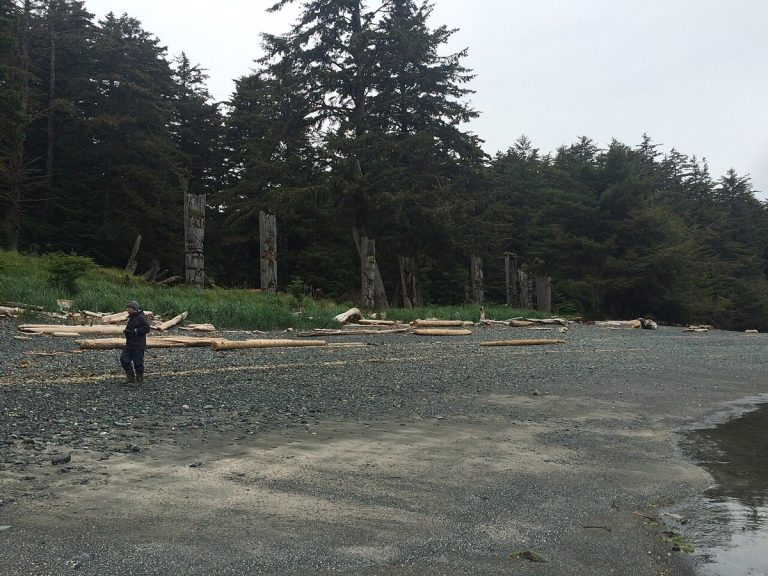
Gwaii Haanas, Haida Gwaii.
CA-K1007Places & geography

Gwaii Haanas, Haida land and sea

On the rainforest islands of Gwaii Haanas, in Haida Gwaii, moss-draped cedar and Sitka spruce tower over the Haida people’s historic carved poles and fallen longhouses. Bald eagles, bears, whales, porpoises and sea lions live here. The land and sea are protected by Parks Canada, Fisheries and Oceans Canada and the Haida, and Haida Gwaii Watchmen share Haida culture at five village sites.

Factual accuracy review: No recorded challenge

Contributor: Citizen.ca

Verified against cited sourcesVerified on 2026-10-27↗
Photo: Christine Rondeau from Vancouver, Canada · Photo licence: CC BY 2.0 · Credit & context
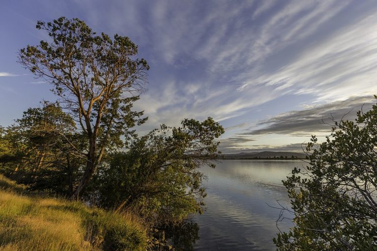
Trees at sunset on Sidney Island, Gulf Islands National Park Reserve.
CA-K1006Places & geography

Gulf Islands National Park Reserve in the Salish Sea

Gulf Islands National Park Reserve protects parts of British Columbia’s southern Gulf Islands in the Salish Sea, off the east coast of Vancouver Island. Eagles and seabirds soar overhead, and the sheltered, islet-dotted waters hold seals, otters, orcas and porpoises. The park reserve has rare ecosystems and a Mediterranean-like climate.

Factual accuracy review: No recorded challenge

Contributor: Citizen.ca

Verified against cited sourcesVerified on 2026-10-27↗
Photo: Michal Klajban · Photo licence: CC BY-SA 4.0 · Credit & context
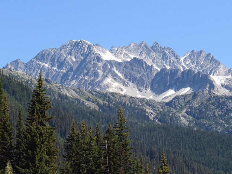
Mountains above Rogers Pass, Glacier National Park.
CA-K1005Places & geography

Glacier National Park in the Columbia Mountains

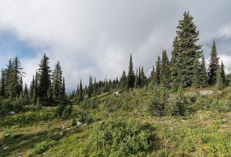
Glacier National Park in British Columbia, together with Mount Revelstoke National Park, represents the Columbia Mountains Natural Region in Canada’s national park system. The Columbia ranges form the first tall mountain barrier east of the Coast Mountains, and the park’s alpine country and old-growth interior rainforest give habitat to many animals.

Factual accuracy review: No recorded challenge

Contributor: Citizen.ca

Verified against cited sourcesVerified on 2026-10-27↗
Photo: Mike · Photo licence: CC BY-SA 2.0 · Credit & context
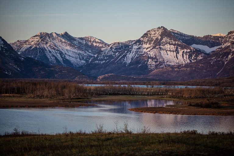
Waterton Lakes National Park.
CA-K1004Places & geography

Waterton Lakes, where prairie meets mountains

Waterton Lakes National Park covers 505 square kilometres in southwestern Alberta, where evergreen forests, wind-swept prairies, steep mountains and deep lakes meet. These varied habitats support more than 250 bird species and over 60 mammal species.

Factual accuracy review: No recorded challenge

Contributor: Citizen.ca

Verified against cited sourcesVerified on 2026-10-27↗
Photo: GlacierNPS · Photo licence: Public domain · Credit & context
A grassland landscape in Elk Island National Park.
CA-K1002Places & geography

Elk Island National Park, near Edmonton

Elk Island National Park lies about 48 kilometres east of downtown Edmonton, in Treaty 6 territory and the Métis homeland. Its rolling hills, lakes and dark skies form a landscape Indigenous Peoples have long used for sustenance, ceremony, trade and travel. The park supports bison, elk and more than 250 bird species.

Factual accuracy review: No recorded challenge

Contributor: Citizen.ca

Verified against cited sourcesVerified on 2026-10-27↗
Photo: Khoshhat · Photo licence: CC0 · Credit & context
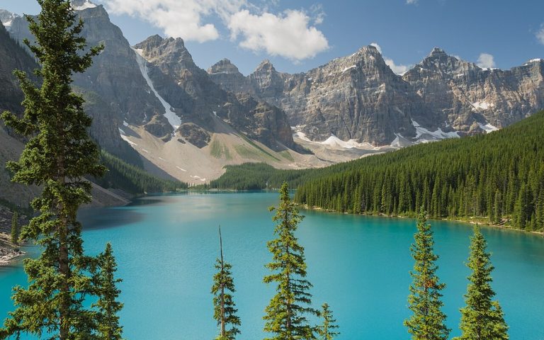
Moraine Lake, Banff National Park.
CA-K1001Places & geography

Banff National Park’s wildlife and plants

The dense forests, glacial waters, high peaks and deep canyons of Banff National Park in Alberta provide habitat for 56 species of mammals, 300 species of birds and more than 800 species of plants. Building on a long history of wildlife research and conservation, Parks Canada works to protect and restore the park for future generations.

Factual accuracy review: No recorded challenge

Contributor: Citizen.ca

Verified against cited sourcesVerified on 2026-10-27↗
Photo: Florian Fuchs · Photo licence: CC BY 3.0 · Credit & context
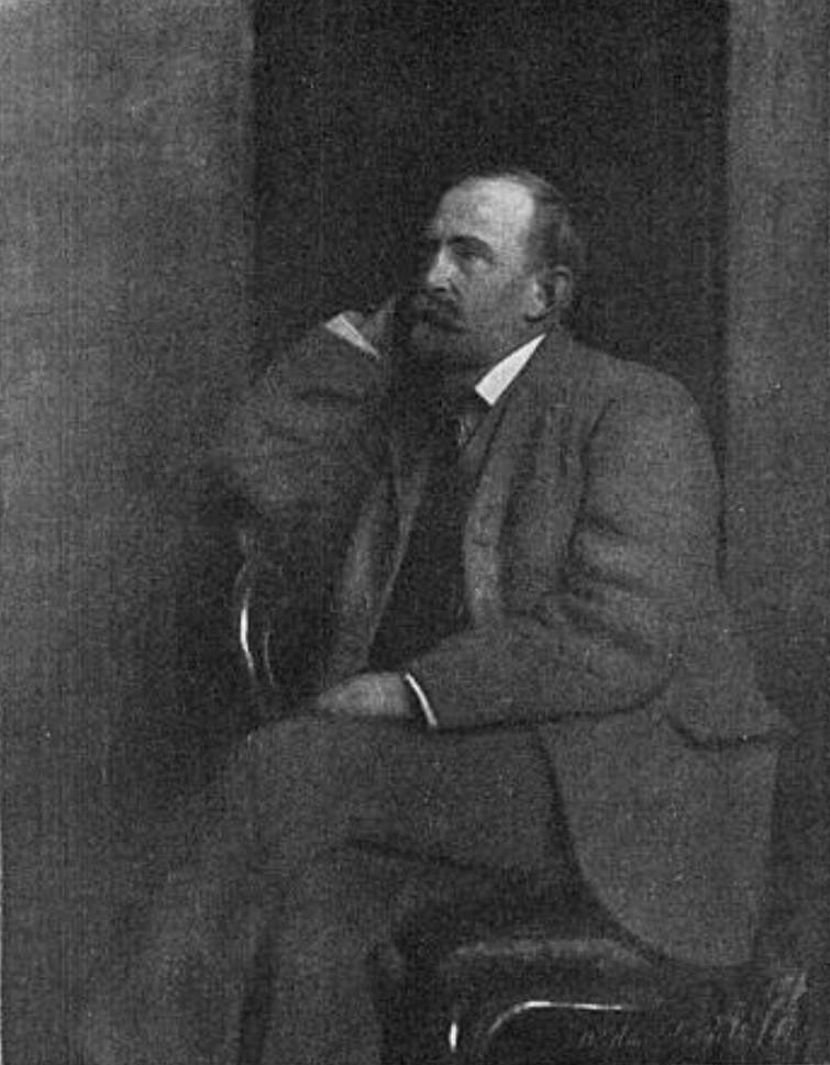
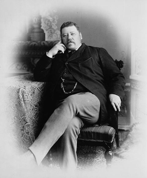
John Norquay, Premier of Manitoba, about 1878.
CA-K1000History

John Norquay, Métis premier of Manitoba

John Norquay, a Métis statesman born at St. Andrew’s in the Red River settlement, was elected to Manitoba’s first assembly in 1870 and became premier in 1878. His government, built on shared French and English participation, won an extended Manitoba boundary and better financial terms from Ottawa, and built railways in defiance of the Canadian Pacific charter and federal disallowance. He resigned as premier in 1887 but sat as a member until his death.

Factual accuracy review: No recorded challenge

Contributor: Citizen.ca

Verified against cited sourcesVerified on 2026-10-27↗
Photo: Unknown author · Photo licence: Public domain · Credit & context
Allan Brooks, 1913.
CA-K998Culture & sport

Allan Brooks, wildlife illustrator

Naturalist Allan Brooks won international recognition as a wildlife illustrator in the first half of the 20th century, influencing later artists. As Western Canada’s leading ornithologist he helped professionalize the field, and he collected thousands of bird and animal skins for major museum research collections. Through his illustrations and publications he introduced generations to the birds of North America.

Factual accuracy review: No recorded challenge

Contributor: Citizen.ca

Verified against cited sourcesVerified on 2026-10-27↗
Photo: William Edwin Gledhill (1888–1976) - photographer · Photo licence: Public domain · Credit & context