An independent Canadian knowledge project

Focused and Verified

Canadian knowledge base

Search by keyword

Choose one keyword, or combine two. Broader keywords include their descendants.

Keywords: Provinces and territories

Clear search
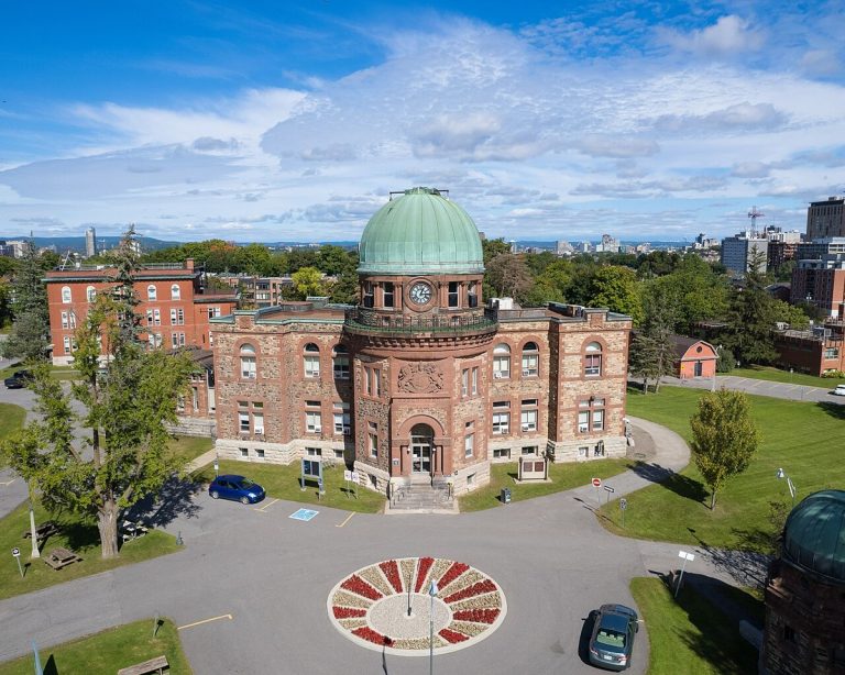
The Dominion Observatory in Ottawa, photographed in 2022.
CA-K340History

The Dominion Observatory, Ottawa

The Dominion Observatory Complex, built between 1902 and 1954 on the grounds of Ottawa’s Central Experimental Farm, is an outstanding collection of early-20th-century scientific buildings. It supported practical astronomy across Canada in surveying, time service and geophysics, and reflects the federal government’s vision of national scientific institutions in the capital.

Factual accuracy review: No recorded challenge

Contributor: Citizen.ca

Verified against cited sourcesVerified on 2026-10-26↗
Photo: Harleyd613 · Photo licence: CC BY-SA 4.0 · Credit & context
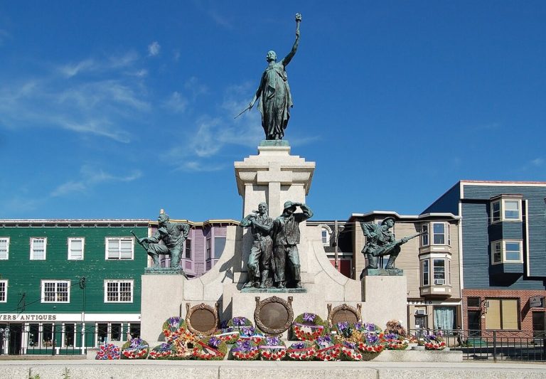
The Newfoundland National War Memorial in St. John’s, photographed in 2008.
CA-K339History

The Newfoundland National War Memorial

The Newfoundland National War Memorial in St. John’s, unveiled in 1924, commemorates the Dominion of Newfoundland’s contributions to the First World War. An allegorical female figure stands above bronze figures representing the Royal Newfoundland Regiment, Royal Naval Reserve, Mercantile Marine and Forestry Corps, beside the harbour where soldiers departed and returned.

Factual accuracy review: No recorded challenge

Contributor: Citizen.ca

Verified against cited sourcesVerified on 2026-10-26↗
Photo: Nilfanion · Photo licence: CC BY-SA 4.0 · Credit & context
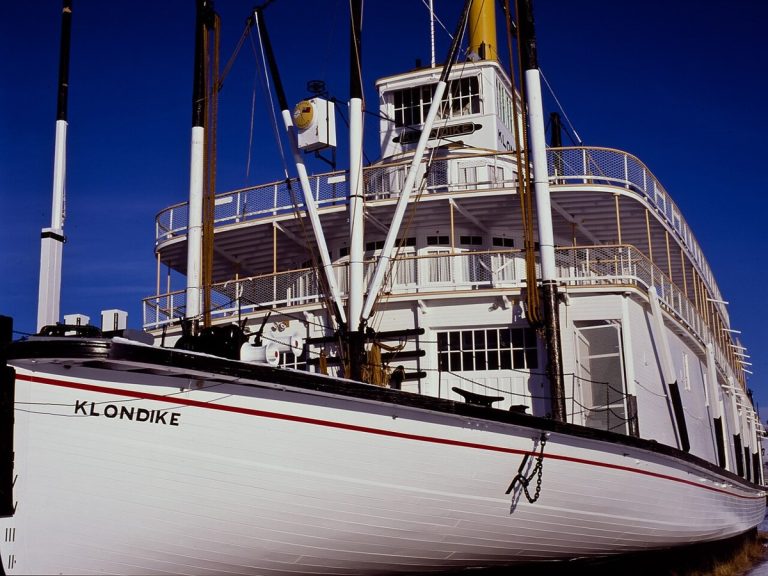
The S.S. Klondike in Whitehorse, Yukon, photographed in winter 2012.
CA-K338History

The S.S. Klondike sternwheeler

The S.S. Klondike, a shallow-draft sternwheeler launched in 1937, carried freight and passengers on the Yukon River until 1955, shortly before commercial navigation on the river ended in 1957. Restored by Parks Canada in Whitehorse, it commemorates inland water transportation in the Yukon.

Factual accuracy review: No recorded challenge

Contributor: Citizen.ca

Verified against cited sourcesVerified on 2026-10-26↗
Photo: Anthony DeLorenzo · Photo licence: CC BY-SA 3.0 · Credit & context
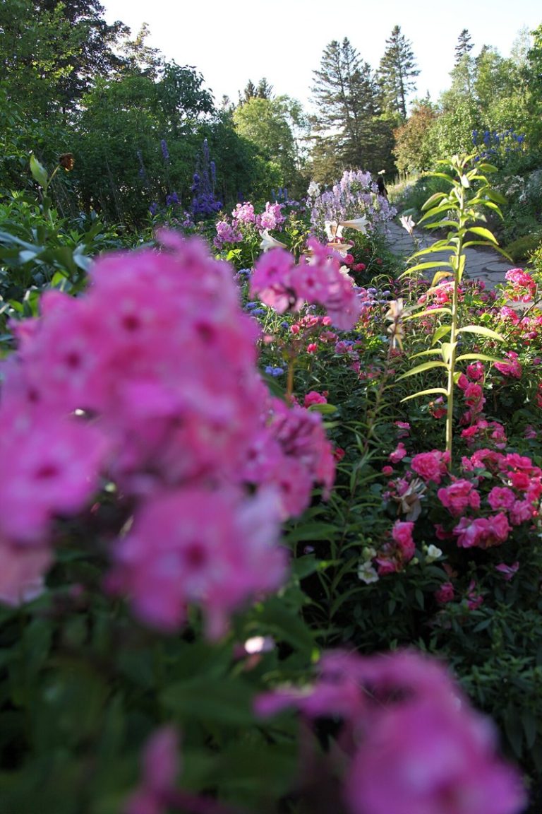
Flower beds and a path at the Jardins de Métis (Reford Gardens), Quebec, photographed in 2015.
CA-K337Culture & sport

Jardins de Métis (Reford Gardens)

The Jardins de Métis (Reford Gardens) in Quebec were created by Elsie Reford from about 1926 to 1958. Their English-inspired design includes specialized gardens, winding paths and an allée royale. The site’s favourable microclimate supports a diverse collection of plants.

Factual accuracy review: No recorded challenge

Contributor: Citizen.ca

Verified against cited sourcesVerified on 2026-10-26↗
Photo: Marc-Lautenbacher · Photo licence: CC BY-SA 4.0 · Credit & context
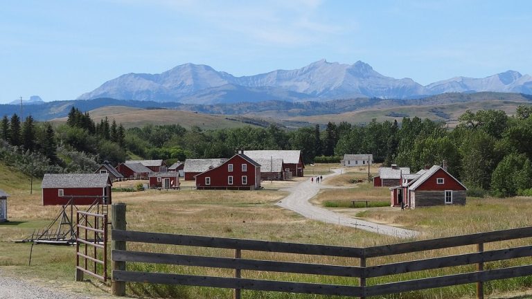
The Bar U Ranch National Historic Site, Alberta, seen from the interpretive centre in 2011.
CA-K336Economy & trade

The Bar U Ranch and Alberta ranching

The Bar U Ranch in the Alberta foothills was established in 1882 under the federal grazing lease policy and played an important role in Canada’s ranching industry. Owned in turn by the North-West Cattle Company, cattleman George Lane and Patrick Burns, the historic ranch represents Alberta ranching from 1880 to 1950.

Factual accuracy review: No recorded challenge

Contributor: Citizen.ca

Verified against cited sourcesVerified on 2026-10-26↗
Photo: David Mathew · Photo licence: CC BY-SA 3.0 · Credit & context
Notre-Dame Cathedral Basilica in Ottawa, photographed in 2017.
CA-K335Culture & sport

Notre-Dame Cathedral Basilica, Ottawa

Notre-Dame Cathedral Basilica in Ottawa, first planned as a parish church in 1839, became cathedral of the new Catholic Diocese of Bytown in 1847 and a basilica in 1879. Its twin spires, Nincheri stained-glass windows and carved sanctuary reflect an exceptional design inspired by the French Gothic Revival, integrating classicism and French-Canadian church architecture.

Factual accuracy review: No recorded challenge

Contributor: Citizen.ca

Verified against cited sourcesVerified on 2026-10-26↗
Photo: Avramescu Marius · Photo licence: CC BY-SA 4.0 · Credit & context
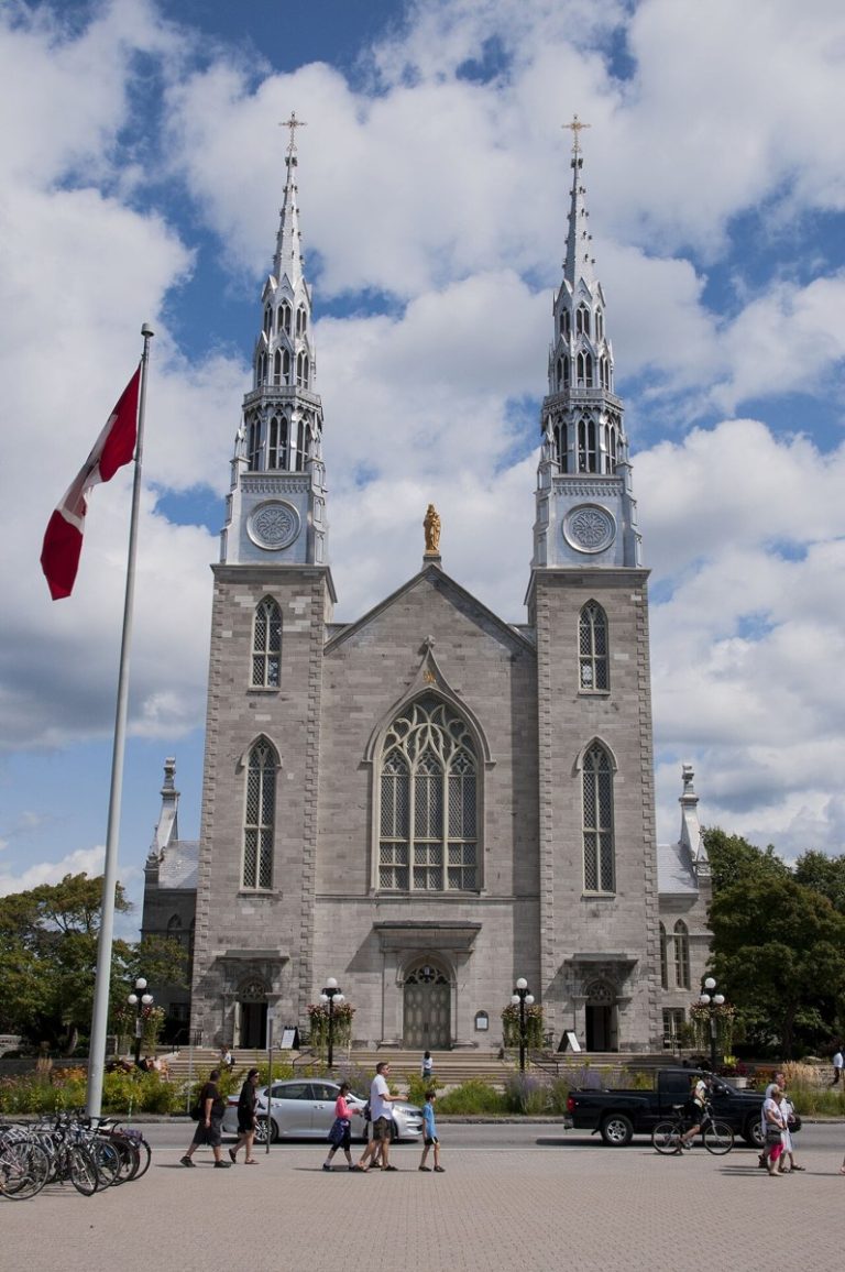
Cabot Tower on Signal Hill, St. John’s, Newfoundland and Labrador, photographed in 2013.
CA-K333History

Signal Hill and Marconi’s 1901 transmission

Signal Hill, overlooking the Narrows into St. John’s Harbour, was important for defence and communications for three centuries, with fortifications built as France and Britain battled for the continent. In 1901, Guglielmo Marconi received the first transatlantic wireless transmission atop the hill, a landmark in global communications history.

Factual accuracy review: No recorded challenge

Contributor: Citizen.ca

Verified against cited sourcesVerified on 2026-10-26↗
Photo: KristaKals · Photo licence: CC BY-SA 3.0 · Credit & context
The Millennium Gate on West Pender Street in Vancouver’s Chinatown, photographed in 2012.
CA-K331History

Vancouver’s Chinatown

Vancouver’s Chinatown, one of the oldest and largest in Canada, developed as a self-segregated enclave partly because of racial hostility elsewhere in the city before the Second World War, and reflects the contributions and struggles of Chinese Canadians. It is known for a distinctive “recessed balcony” architecture that blends Chinese regional styles with western building methods.

Factual accuracy review: No recorded challenge

Contributor: Citizen.ca

Verified against cited sourcesVerified on 2026-10-26↗
Photo: MRDXII · Photo licence: CC BY-SA 3.0 · Credit & context
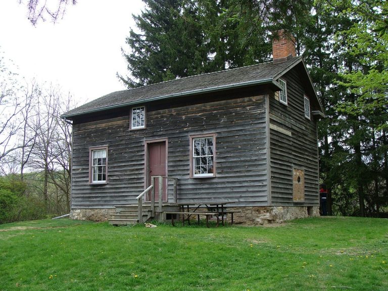
Griffin House in Ancaster, Ontario, photographed in 2010.
CA-K329History

Griffin House, Ancaster

Griffin House in Ancaster, Ontario, was the home of Enerals Griffin, a Black immigrant from Virginia who settled there in 1834, and remained in his family for 154 years. A rare surviving example of early Upper Canadian vernacular housing, it shows the complexity of the Black experience: it was more elaborate than most refugees’ homes and stood in a mainly Euro-Canadian community rather than a planned refugee settlement.

Factual accuracy review: No recorded challenge

Contributor: Citizen.ca

Verified against cited sourcesVerified on 2026-10-26↗
Photo: Graeme MacKay from Hamilton, Ontario, Canada · Photo licence: CC BY 2.0 · Credit & context
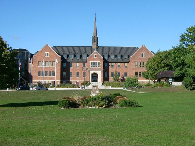
Shingwauk Hall, the former school’s main building, now part of Algoma University in Sault Ste. Marie, photographed in 2012.
CA-K328Indigenous peoples & reconciliation

The former Shingwauk Indian Residential School

The Shingwauk Indian Residential School in Sault Ste. Marie, Ontario, opened by the Anglican Church in 1875 and closed in 1970, was part of the residential school system that sought to assimilate Indigenous children by separating them from their families, cultures and languages. Named for Chief Shingwaukonse, whose vision of education was lost, it was a Shingwauk school “in name only”; its main building, Shingwauk Hall, is one of the few remaining residential school buildings in Canada.

Factual accuracy review: No recorded challenge

Contributor: Citizen.ca

Verified against cited sourcesVerified on 2026-10-26↗
Photo: Fungus Guy · Photo licence: CC BY-SA 3.0 · Credit & context
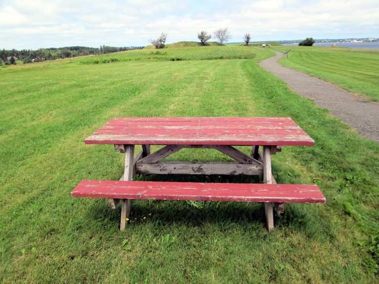
The site of Fort Amherst, Prince Edward Island, photographed in 2013.
CA-K325History

Skmaqn–Port-la-Joye–Fort Amherst

Skmaqn–Port-la-Joye–Fort Amherst, on Prince Edward Island, was the seat of colonial government from 1720 to 1768, first under the French and then the British. It was a port of entry and a place where Mi’kmaq and French leaders renewed their alliance. In 1758, British authorities used Fort Amherst to organize the forcible removal of more than 3,000 Acadians from the island.

Factual accuracy review: No recorded challenge

Contributor: Citizen.ca

Verified against cited sourcesVerified on 2026-10-26↗
Photo: Larry from Charlottetown, PEI, Canada · Photo licence: CC BY 2.0 · Credit & context
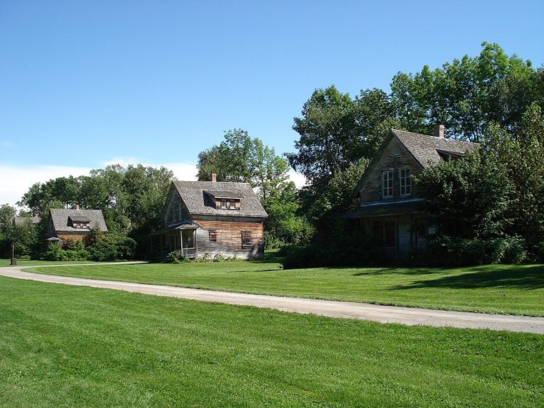
Houses in the ghost town of Val-Jalbert, Quebec, photographed in 2008.
CA-K319Economy & trade

Val-Jalbert, a pulp and paper company town

Val-Jalbert, near Lac Saint-Jean in Quebec, was founded in 1901 around a pulp and paper mill. The mill’s closure in 1927 led to the village’s gradual abandonment. Its mill, institutional buildings and wooden workers’ houses were conserved and developed as an open-air museum in the early 1960s, reflecting growing interest in heritage preservation.

Factual accuracy review: No recorded challenge

Contributor: Citizen.ca

Verified against cited sourcesVerified on 2026-10-26↗
Photo: Mathieu BROSSAIS · Photo licence: CC BY 4.0 · Credit & context
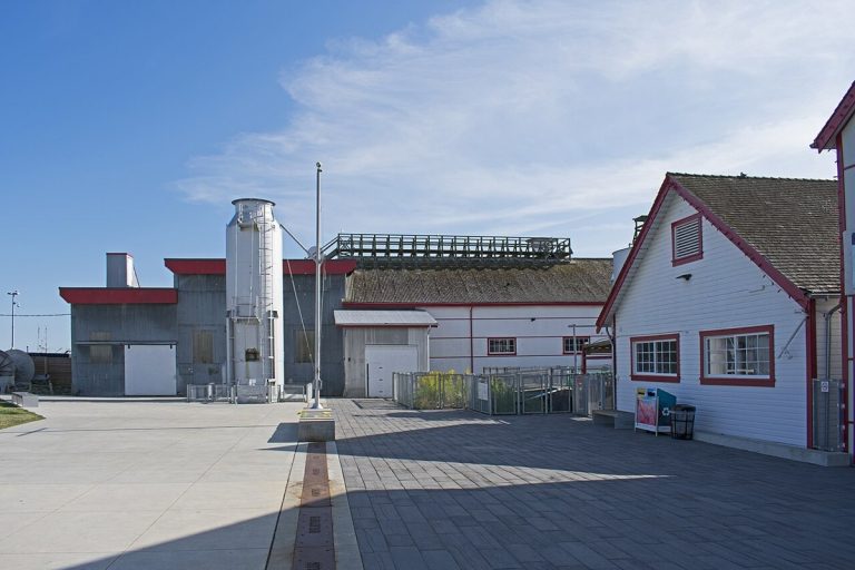
The Gulf of Georgia Cannery in Steveston, Richmond, British Columbia, photographed in 2019.
CA-K318Economy & trade

The Gulf of Georgia Cannery, Steveston

The Gulf of Georgia Cannery, a large complex of wooden fish-processing and canning buildings on a wharf at the mouth of the Fraser River in Steveston, British Columbia, recalls the West Coast fishing industry from the 1870s on. Its buildings, built and modified between 1894 and 1964, stand in what was historically the most important fishing village on the West Coast.

Factual accuracy review: No recorded challenge

Contributor: Citizen.ca

Verified against cited sourcesVerified on 2026-10-26↗
Photo: Ymblanter · Photo licence: CC BY-SA 4.0 · Credit & context
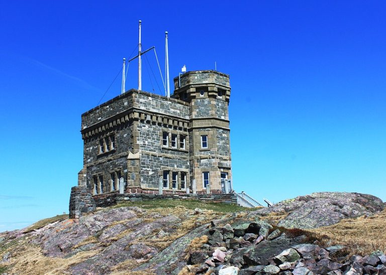
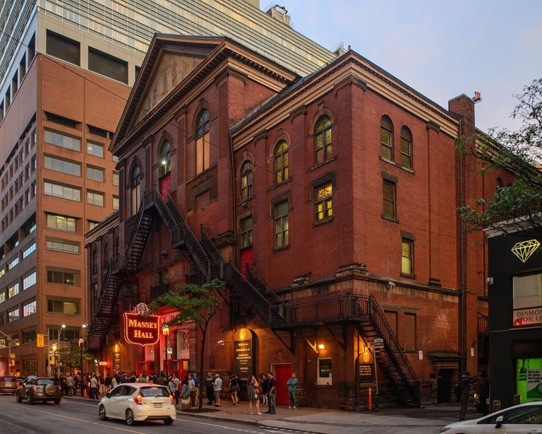
Massey Hall in downtown Toronto, photographed in 2017.
CA-K317Culture & sport

Massey Hall, Toronto’s concert hall since 1894

Massey Hall, a red-brick concert hall in downtown Toronto that opened in 1894, was a gift to the city from industrialist Hart Massey. Toronto’s major concert hall for much of the 20th century, it is one of Canada’s most important cultural institutions and renowned for its outstanding acoustics.

Factual accuracy review: No recorded challenge

Contributor: Citizen.ca

Verified against cited sourcesVerified on 2026-10-26↗
Photo: Arild Vågen · Photo licence: CC BY-SA 4.0 · Credit & context
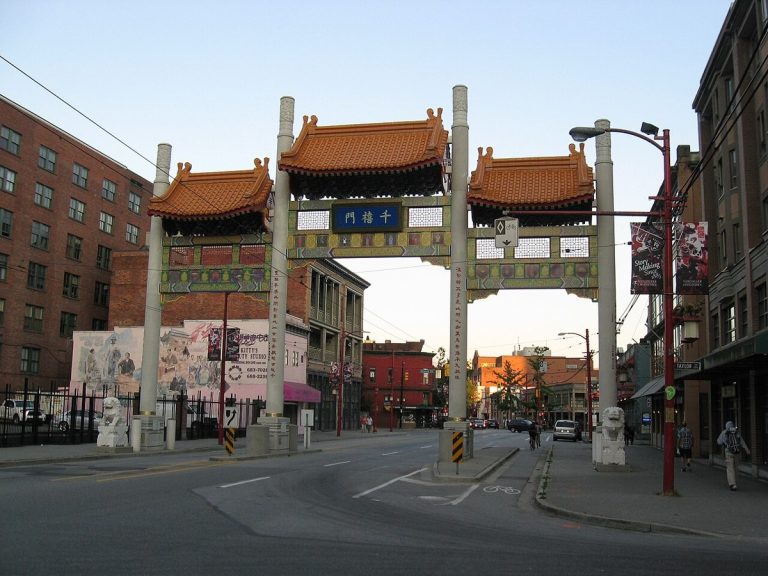
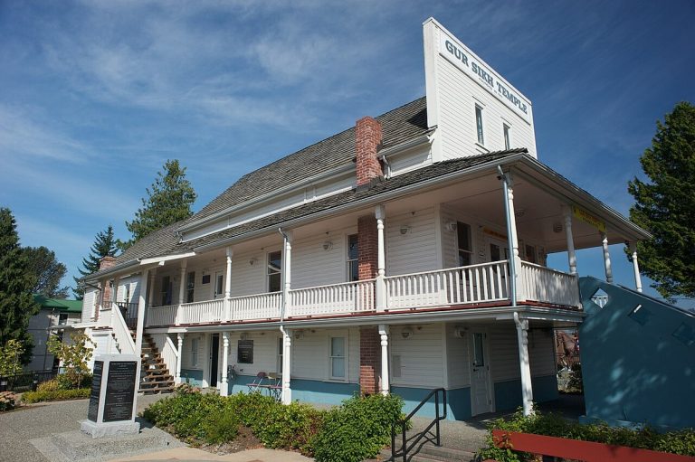
The Gur Sikh Temple (Abbotsford Sikh Temple), British Columbia, photographed in 2012.
CA-K314History

The Abbotsford Sikh Temple, 1911

The Abbotsford Sikh Temple in British Columbia, built in 1911 and used continuously since, is the oldest surviving example of the temples that played a crucial religious, social and political role in the pioneer phase of Sikh immigration to North America. Its simple false-front wooden building adapts Sikh traditions to a Canadian architectural form.

Factual accuracy review: No recorded challenge

Contributor: Citizen.ca

Verified against cited sourcesVerified on 2026-10-26↗
Photo: Jacobsimmonds · Photo licence: CC BY-SA 3.0 · Credit & context
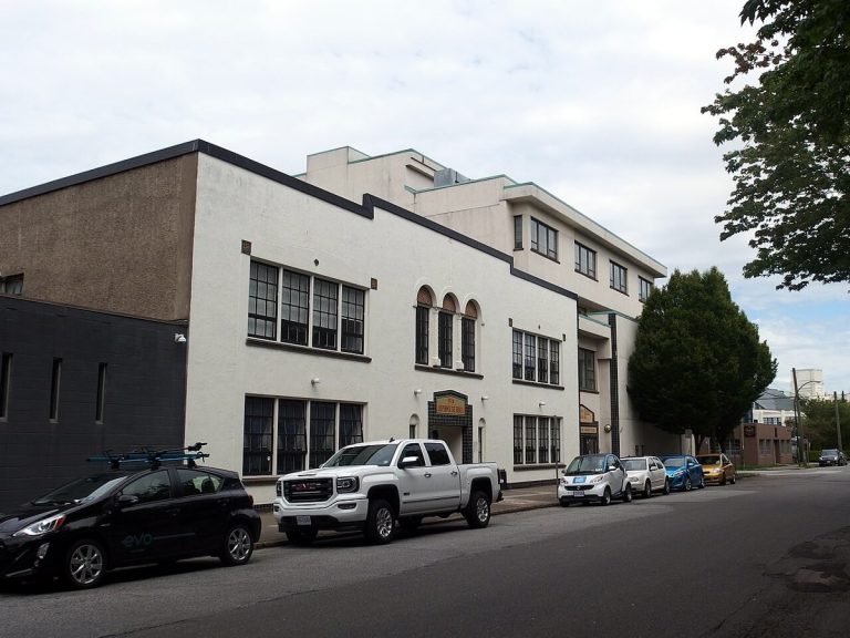
The Vancouver Japanese Language School and Hall on Alexander Street, Vancouver, photographed in 2016.
CA-K313Language & names

The Vancouver Japanese Language School

The Vancouver Japanese Language School, in the city’s Japantown, was the first and largest Japanese language school in Canada, and its 1928 Art Deco building is a rare surviving interwar language school. Of the thousands of properties the federal government confiscated from Japanese Canadians during the Second World War, it is one of very few known buildings returned to its owners after internment.

Factual accuracy review: No recorded challenge

Contributor: Citizen.ca

Verified against cited sourcesVerified on 2026-10-26↗
Photo: Cordovanorth · Photo licence: CC BY-SA 4.0 · Credit & context
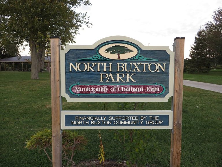
A sign for North Buxton Park in the Buxton Settlement area, Ontario, photographed in 2015; it does not show the settlement’s original buildings.
CA-K312History

The Buxton Settlement, a planned refugee community

The Buxton Settlement National Historic Site in southwestern Ontario encompasses a cultural landscape of about 4,680 hectares, including North and South Buxton. Its farms, religious institutions and schools preserve the history of a planned settlement founded by Underground Railroad refugees and remain a living memorial to its founders.

Factual accuracy review: No recorded challenge

Contributor: Citizen.ca

Verified against cited sourcesVerified on 2026-10-26↗
Photo: Ken Lund from Reno, Nevada, USA · Photo licence: CC BY-SA 2.0 · Credit & context
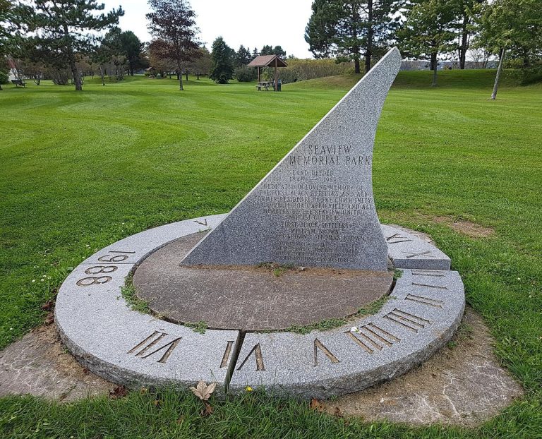
The Africville Monument at Seaview Memorial Park, Halifax, listing the community’s founding families, photographed in 2017.
CA-K311History

Africville, a site of remembrance

Africville, on Bedford Basin in Halifax, was a Black community settled in the 1830s and 1840s, with its own school and church. Its houses were demolished in the 1960s in the name of urban renewal and the land became Seaview Park; the clearance became an enduring symbol to Black Canadians of the need to defend their institutions, and the site is now a place of remembrance and pilgrimage.

Factual accuracy review: No recorded challenge

Contributor: Citizen.ca

Verified against cited sourcesVerified on 2026-10-26↗
Photo: Coastal Elite from Halifax, Canada · Photo licence: CC BY-SA 2.0 · Credit & context
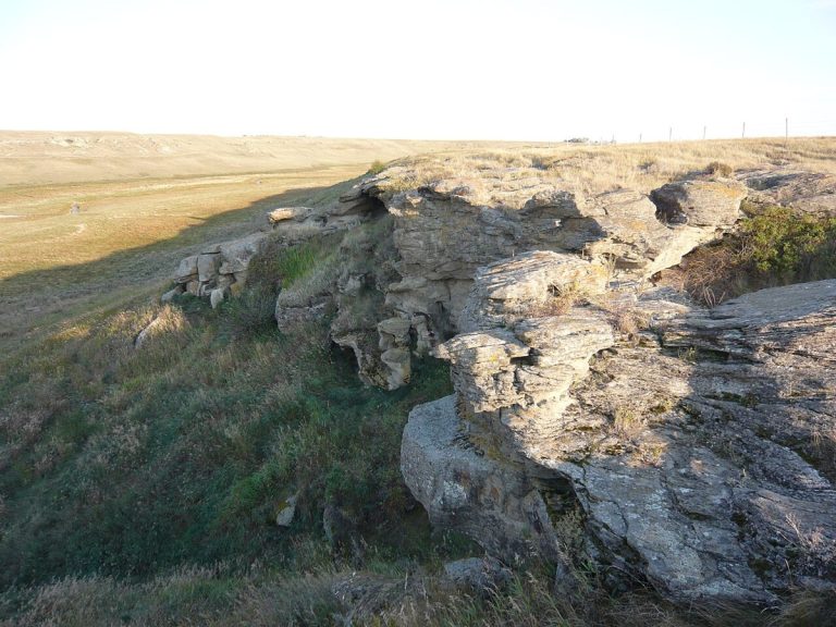
Old Women’s Buffalo Jump near Cayley, Alberta, photographed in 2009.
CA-K308Indigenous peoples & reconciliation

Old Women’s Buffalo Jump

Old Women’s Buffalo Jump, in the Alberta foothills near Cayley, was used continuously for roughly 2,000 years, leaving archaeological deposits more than six metres deep at the base of its sandstone cliff. It was the site of the first major excavation of a buffalo jump on the Canadian Prairies.

Factual accuracy review: No recorded challenge

Contributor: Citizen.ca

Verified against cited sourcesVerified on 2026-10-26↗
Photo: Grapher78 · Photo licence: CC BY 3.0 · Credit & context
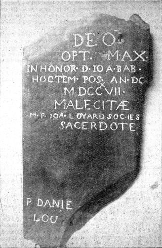
A stone tablet dated 1717 from the French mission chapel at Meductic, as recorded around 1897.
CA-K307Indigenous peoples & reconciliation

Mehtawtik (Meductic), a Wolastoqey village

Mehtawtik (Meductic), on the west bank of the Wəlastəkw (Saint John River) in New Brunswick, was the principal settlement of the Wəlastəkwiyik (Maliseet) from before the 17th century, valued for hunting, fishing and fertile soil where families planted corn. The village site has been under the waters of the Mactaquac hydroelectric dam since 1968.

Factual accuracy review: No recorded challenge

Contributor: Citizen.ca

Verified against cited sourcesVerified on 2026-10-26↗
Photo: W.O. Raymond. · Photo licence: Public domain · Credit & context
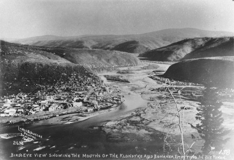
The mouths of Bonanza Creek and the Klondike River at the Yukon River, photographed in 1900 by Larss & Duclos.
CA-K306Indigenous peoples & reconciliation

Tr’ochëk, “the place at the mouth of the river”

Tr’ochëk, at the confluence of the Yukon and Klondike rivers just south of Dawson City, represents the Hän cultural landscape of the middle Yukon River valley. For countless generations the Hän spent mid-summer to late fall at fishing camps there; its name means “the place at the mouth of the river,” and it is the Tr’ondëk Hwëch’in “home” on the Yukon River.

Factual accuracy review: No recorded challenge

Contributor: Citizen.ca

Verified against cited sourcesVerified on 2026-10-26↗
Photo: Larss & Duclos · Photo licence: CC BY-SA 4.0 · Credit & context
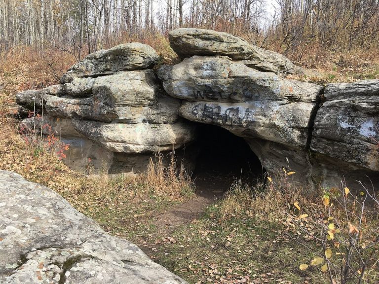
The front of the Tse’K’wa (Charlie Lake) cave, British Columbia, photographed in 2017.
CA-K305Indigenous peoples & reconciliation

Tse’K’wa, 12,500 years of human presence

Tse’K’wa, a cave near Fort St. John, British Columbia, in Dane-zaa traditional territory, holds a rare sequence of soil layers recording human settlement and environmental change from the end of the last glacial period, 12,500 years ago, to 1,000 years ago. Its lowest layers contained Palaeo-Indian stone tools, bones of late glacial animals, evidence of bison hunting and two nearly complete raven skeletons.

Factual accuracy review: No recorded challenge

Contributor: Citizen.ca

Verified against cited sourcesVerified on 2026-10-26↗
Photo: Breckenheimer · Photo licence: CC BY-SA 4.0 · Credit & context
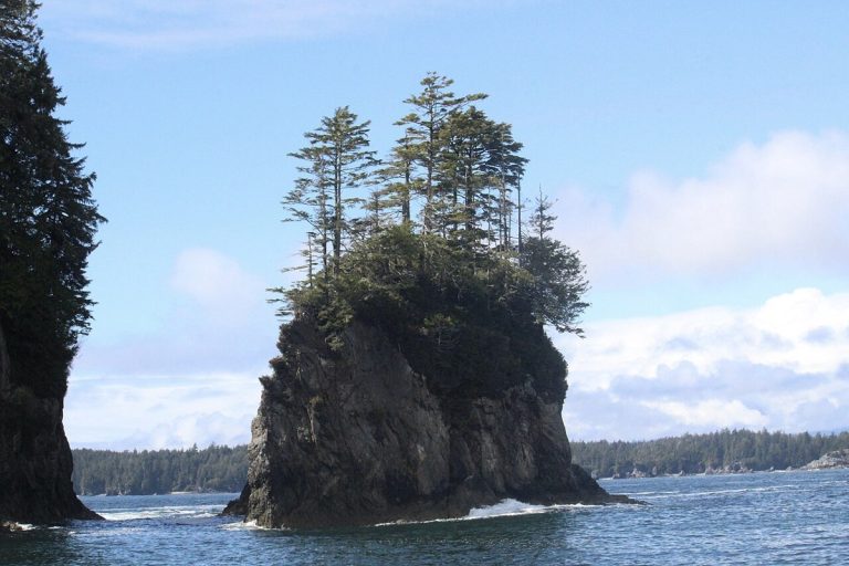
The beach at Kiix̣in National Historic Site, Vancouver Island, photographed in 2024.
CA-K303Indigenous peoples & reconciliation

Kiix̣in, the Huu-ay-aht capital village

Kiix̣in Village and Fortress, at Barkley Sound on Vancouver Island’s west coast, was the traditional capital village of the Huu-ay-aht, a Nuu-chah-nulth First Nation. Its archaeological remains record almost 3,000 years of occupation, and its surviving traditional architecture is rare on the southern British Columbia coast. The site remains sacred to the Huu-ay-aht.

Factual accuracy review: No recorded challenge

Contributor: Citizen.ca

Verified against cited sourcesVerified on 2026-10-26↗
Photo: Qwexcxewq · Photo licence: CC BY 4.0 · Credit & context
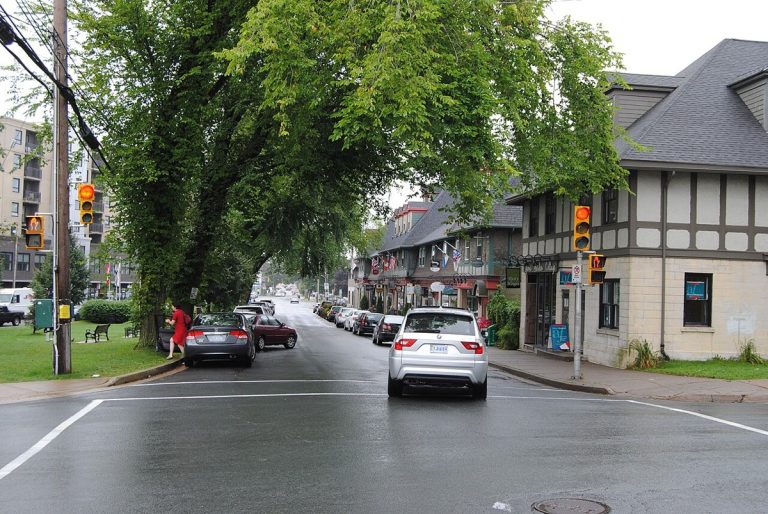
The Hydrostone district in Halifax, Nova Scotia, photographed in 2011.
CA-K287Institutions

Thomas Adams and the Hydrostone

Thomas Adams (1871–1940), a leading town planner in early-20th-century Canada, influenced provincial planning laws in seven provinces and led the early professionalization of planning. He designed public housing projects such as Lindenlea in Ottawa and the Hydrostone district of Halifax, planned to rebuild the Richmond neighbourhood after the 1917 Halifax Explosion.

Factual accuracy review: No recorded challenge

Contributor: Citizen.ca

Verified against cited sourcesVerified on 2026-10-26↗
Photo: Paul from Hacketts Cove, Canada · Photo licence: CC BY 2.0 · Credit & context