An independent Canadian knowledge project

Focused and Verified

Canadian knowledge base

Search by keyword

Choose one keyword, or combine two. Broader keywords include their descendants.

Keywords: Place or geographic feature

Clear search
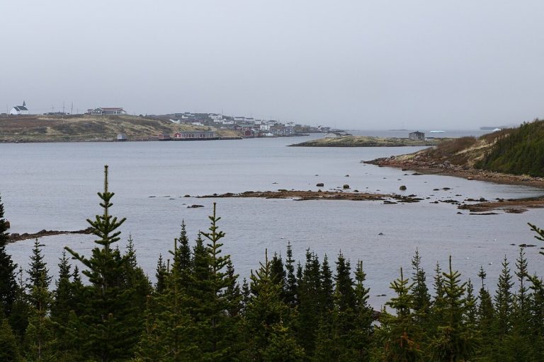
Red Bay, Newfoundland and Labrador, photographed in 2017.
CA-K241History

Red Bay, a 16th-century Basque whaling station

From the 1540s to the early 1600s, up to 2,000 Basque men and boys sailed each year from southern France and northern Spain to the Strait of Belle Isle to hunt right whales and render their blubber into oil for European markets. Red Bay, Labrador, a UNESCO World Heritage Site since 2013, is the most extensive and best-preserved whaling station of its kind.

Factual accuracy review: No recorded challenge

Contributor: Citizen.ca

Verified against cited sourcesVerified on 2026-10-26↗
Photo: Cephas · Photo licence: CC BY-SA 4.0 · Credit & context
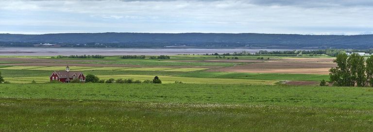
The Landscape of Grand Pré World Heritage Site, Nova Scotia, photographed in 2018.
CA-K240History

The Landscape of Grand Pré and its Acadian dykelands

The Landscape of Grand Pré in Nova Scotia, a UNESCO World Heritage Site since 2012, bears exceptional testimony to a farming settlement the Acadians created in the 17th century beside some of the world’s highest tides. They reclaimed land from the sea with dykes, aboiteaux and drainage, under a community-based management system still in use today.

Factual accuracy review: No recorded challenge

Contributor: Citizen.ca

Verified against cited sourcesVerified on 2026-10-26↗
Photo: Mykola Swarnyk · Photo licence: CC BY-SA 3.0 · Credit & context
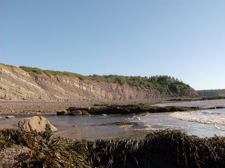
The Joggins Fossil Cliffs near Joggins, Nova Scotia, photographed in 2010.
CA-K239Places & geography

Joggins Fossil Cliffs, the “Coal Age Galápagos”

About 300 million years ago, the eastern shore of Chignecto Bay, on the Bay of Fundy, was a tropical wetland forest near the equator. The Joggins Fossil Cliffs in Nova Scotia, a UNESCO World Heritage Site since 2008, hold the best and most complete known fossil record of land life in the “Coal Age,” including the first reptiles in Earth’s history.

Factual accuracy review: No recorded challenge

Contributor: Citizen.ca

Verified against cited sourcesVerified on 2026-10-26↗
Photo: Gorob · Photo licence: CC BY-SA 3.0 · Credit & context
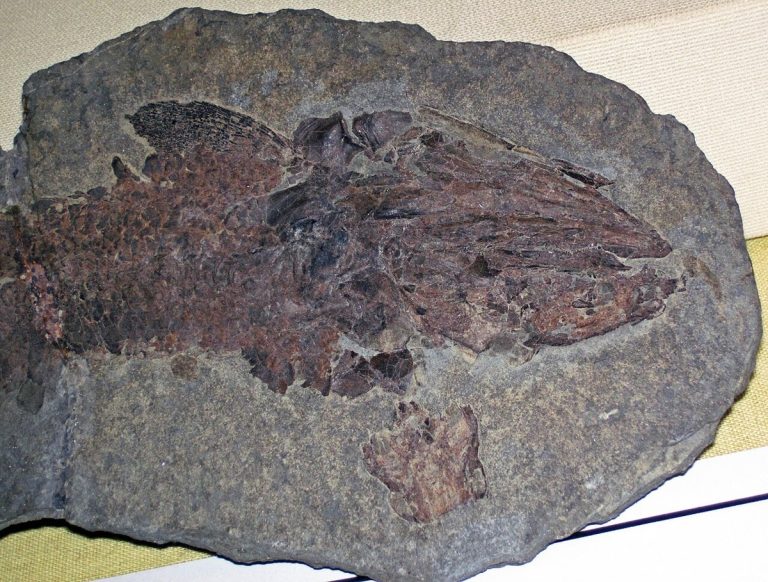
A fossil of the lobe-finned fish Eusthenopteron foordi from the Devonian of the Gaspé Peninsula, photographed in 2017.
CA-K238Places & geography

Miguasha and the “Age of Fishes”

Miguasha National Park, on Quebec’s Gaspé Peninsula, preserves fossils from about 370 million years ago, when the coast was a tropical estuary. A UNESCO World Heritage Site since 1999, it is described as the world’s most outstanding fossil site for illustrating the Devonian “Age of Fishes,” including lobe-finned fish linked to the evolution of four-limbed animals.

Factual accuracy review: No recorded challenge

Contributor: Citizen.ca

Verified against cited sourcesVerified on 2026-10-26↗
Photo: James St. John · Photo licence: CC BY 2.0 · Credit & context
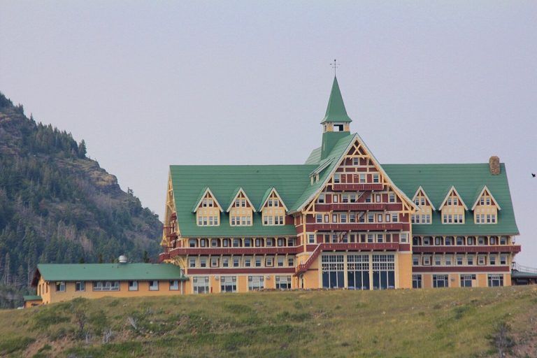
The Prince of Wales Hotel in Waterton Lakes National Park, Alberta, photographed in 2013.
CA-K237Places & geography

Waterton-Glacier, the world’s first international peace park

In 1931, the Rotary Clubs of Alberta and Montana proposed uniting Waterton Lakes National Park in Alberta and Glacier National Park in Montana as the Waterton-Glacier International Peace Park, the first such park in the world. It was meant to promote peace and goodwill between nations and to underline the international nature of wilderness; it became a UNESCO World Heritage Site in 1995.

Factual accuracy review: No recorded challenge

Contributor: Citizen.ca

Verified against cited sourcesVerified on 2026-10-26↗
Photo: Royalbroil · Photo licence: CC BY-SA 3.0 · Credit & context
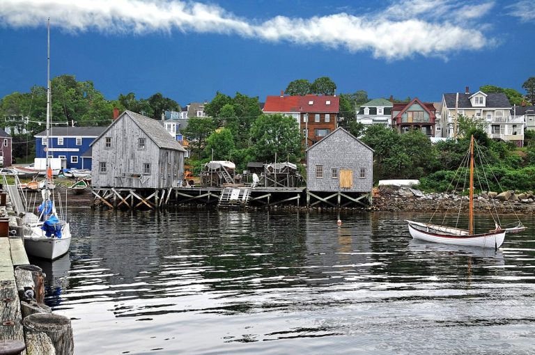
Part of the Lunenburg waterfront, Nova Scotia, photographed in 2011.
CA-K236History

Old Town Lunenburg, a British colonial model town

Old Town Lunenburg, on Nova Scotia’s south coast, is the best surviving example of the British colonial policy of founding settlements on a pre-designed “model town” plan, with straight streets and square corners. Of at least 21 North American settlements laid out this way, none survives in such pristine condition; it became a UNESCO World Heritage Site in 1995.

Factual accuracy review: No recorded challenge

Contributor: Citizen.ca

Verified against cited sourcesVerified on 2026-10-26↗
Photo: Dennis G. Jarvis · Photo licence: CC BY-SA 2.0 · Credit & context
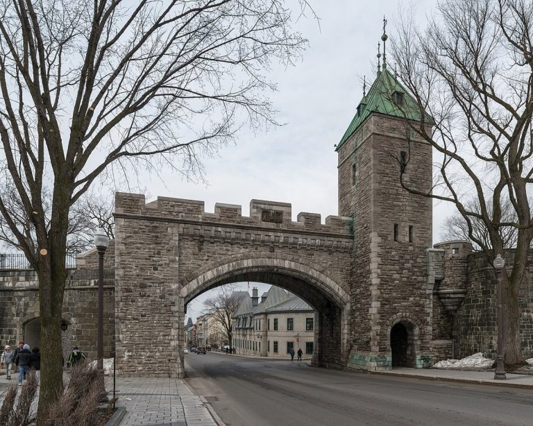
Porte Saint-Louis, a gate in the walls of Old Québec, photographed in 2017.
CA-K235History

Old Québec, a walled city

The Historic District of Old Québec, a UNESCO World Heritage Site since 1985, covers 135 hectares, and close to half its buildings were built before 1850. Québec has retained almost all its fortifications, a defining feature of the historic district.

Factual accuracy review: No recorded challenge

Contributor: Citizen.ca

Verified against cited sourcesVerified on 2026-10-26↗
Photo: DXR · Photo licence: CC BY-SA 4.0 · Credit & context
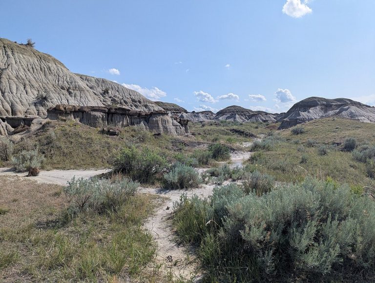
The badlands of Dinosaur Provincial Park, Alberta, photographed in 2025.
CA-K234Places & geography

Dinosaur Provincial Park’s Cretaceous fossils

Dinosaur Provincial Park in eastern Alberta, a UNESCO World Heritage Site since 1979, preserves fossils from about 75 million years ago, when the area was a coastal plain where about 35 species of dinosaur lived. Its badlands are outstanding for the number and variety of high-quality specimens representing every known group of Cretaceous dinosaurs.

Factual accuracy review: No recorded challenge

Contributor: Citizen.ca

Verified against cited sourcesVerified on 2026-10-26↗
Photo: Hirgax · Photo licence: CC BY-SA 4.0 · Credit & context
Pauline Cove on Qikiqtaruk (Herschel Island), Yukon, photographed in 2025.
CA-K216Places & geography

Qikiqtaruk (Herschel Island), Arctic whaling base

Qikiqtaruk (Herschel Island), off the Yukon coast, became the principal base for American whalers in the western Arctic in 1890. Parks Canada’s commemorative plaque records a community of about 2,000 whalers and Inuit during the peak winter of 1894–1895.

Factual accuracy review: No recorded challenge

Contributor: Citizen.ca

Verified against cited sourcesVerified on 2026-10-26↗
Photo: Carina Gsottbauer · Photo licence: CC BY-SA 4.0 · Credit & context
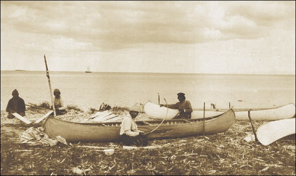
Innu making canoes near Sheshatshiu, Labrador, around 1920; a historical image of canoe-making, not a view of the complete travel route.
CA-K157Indigenous peoples & reconciliation

Meshikamau-shipu, an Innu travel route

Meshikamau-shipu, Innu-aimun for “river to Meshikamau,” is a travel route of about 330 kilometres through rivers and lakes in Labrador, from Sheshatshiu to the Meshikamau area. Its camp sites, some dating back 3,500 years, portages and burial places reflect Innu land use and a way of life based on mobility until permanent settlement in the 1960s.

Factual accuracy review: No recorded challenge

Contributor: Citizen.ca

Verified against cited sourcesVerified on 2026-10-26↗
Photo: Photo by Fred C. Sears. Courtesy of Library and Archives Canada (PA-148593). · Photo licence: Public domain · Credit & context
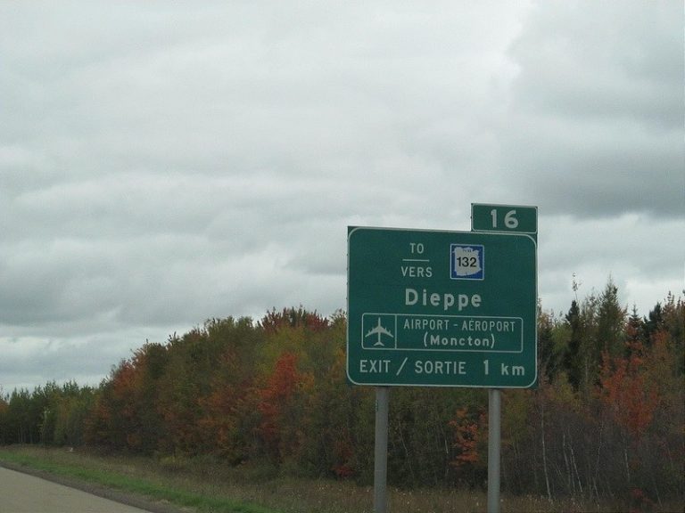
A bilingual road sign in New Brunswick pointing to Dieppe and the airport, photographed in 2012.
CA-K127Language & names

New Brunswick, Canada’s only officially bilingual province

New Brunswick’s first Official Languages Act, enacted on 18 April 1969, made it Canada’s first and only officially bilingual province. The Act made English and French the province’s two official languages and recognized the right to receive provincial government services in either.

Factual accuracy review: No recorded challenge

Contributor: Citizen.ca

Verified against cited sourcesVerified on 2026-10-26↗
Photo: Doug Kerr · Photo licence: CC BY-SA 2.0 · Credit & context
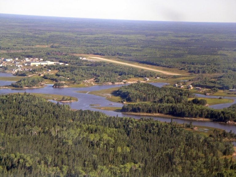
A First Nations community at Bloodvein River on Lake Winnipeg, Manitoba, in 2003; a view of the wider region, not the World Heritage property itself.
CA-K120Indigenous peoples & reconciliation

Pimachiowin Aki, “the land that gives life”

Pimachiowin Aki, Anishinaabemowin (Ojibwe) for “the land that gives life,” is a boreal forest in Manitoba and Ontario under Indigenous stewardship. Inscribed in 2018, it is Canada’s first mixed (natural and cultural) World Heritage property and testifies to the Anishinaabe tradition of Ji-ganawendamang Gidakiiminaan (Keeping the Land).

Factual accuracy review: No recorded challenge

Contributor: Citizen.ca

Verified against cited sourcesVerified on 2026-10-26↗
Photo: Timkal · Photo licence: CC BY-SA 3.0 · Credit & context
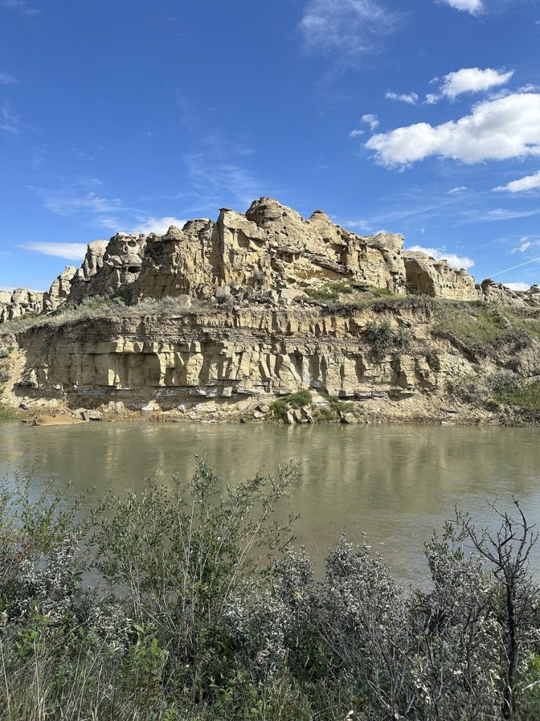
The Milk River and hoodoos at Writing-on-Stone Provincial Park, Alberta, in 2025; it does not show the rock art.
CA-K119Indigenous peoples & reconciliation

Writing-on-Stone / Áísínai’pi, a sacred Blackfoot landscape

Writing-on-Stone / Áísínai’pi, in Alberta’s Milk River Valley, is a sacred site where the Blackfoot (Siksikáítsitapi) left engravings and paintings on the sandstone walls. The landscape remains sacred to the Blackfoot and was inscribed as a UNESCO World Heritage Site in 2019.

Factual accuracy review: No recorded challenge

Contributor: Citizen.ca

Verified against cited sourcesVerified on 2026-10-26↗
Photo: Nodin Cutfeet · Photo licence: CC BY 4.0 · Credit & context
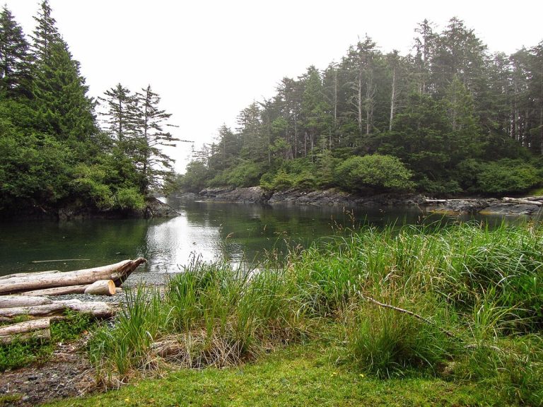
A wooded coastal view at SG̱ang Gwaay Llnagaay, photographed in 2016; the photograph does not show the village’s poles.
CA-K118Indigenous peoples & reconciliation

SG̱ang Gwaay: a Haida village and its poles

SG̱ang Gwaay Llnagaay (Nan Sdins), on an island at the southern tip of Haida Gwaii, British Columbia, bears unique testimony to Haida culture. The 19th-century village keeps the remains of 10 houses and 32 memorial or mortuary poles, and was inscribed as a UNESCO World Heritage Site in 1981.

Factual accuracy review: No recorded challenge

Contributor: Citizen.ca

Verified against cited sourcesVerified on 2026-10-26↗
Photo: Yvrsigmatech · Photo licence: Public domain · Credit & context
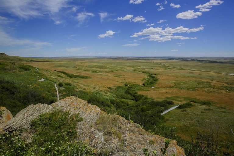
Head-Smashed-In Buffalo Jump World Heritage Site, Alberta, photographed in 2017.
CA-K117Indigenous peoples & reconciliation

Head-Smashed-In Buffalo Jump

Head-Smashed-In Buffalo Jump (estipah-skikikini-kots in Blackfoot), in southwestern Alberta, is the biggest, oldest and best-preserved buffalo jump in North America. Plains peoples drove bison over its cliffs for perhaps 5,700 years, until the mid-19th century; it became a UNESCO World Heritage Site in 1981.

Factual accuracy review: No recorded challenge

Contributor: Citizen.ca

Verified against cited sourcesVerified on 2026-10-26↗
Photo: Thomas Fuhrmann · Photo licence: CC BY-SA 4.0 · Credit & context
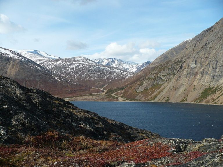
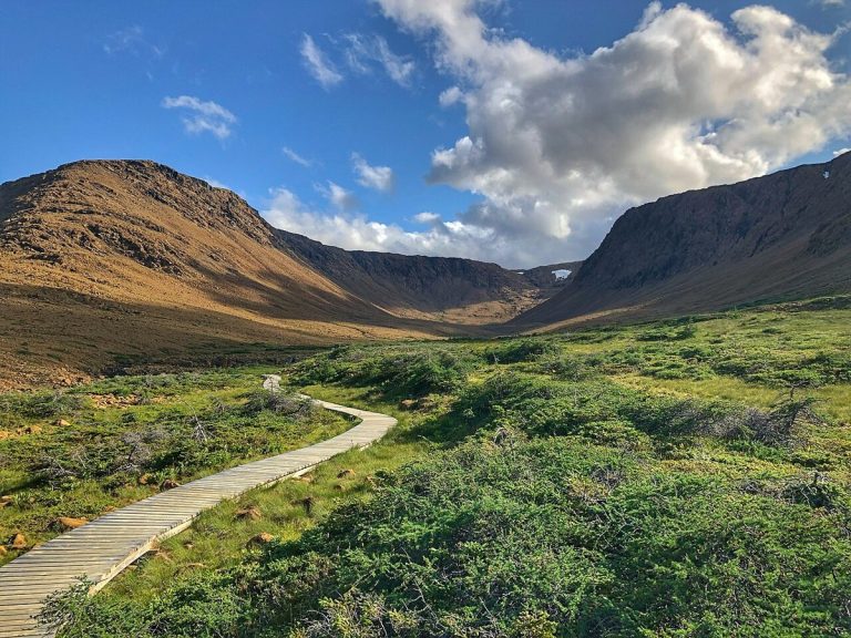
Nachvak Fjord in the Torngat Mountains, Labrador, photographed in 2008.
CA-K112Indigenous peoples & reconciliation

The Torngat Mountains, an Inuit homeland

The subarctic Torngat Mountains of northern Labrador are an Inuit homeland, rich in stories and traditions. Torngat Mountains National Park protects a landscape of glacier-carved fjords and some of Earth’s oldest rocks.

Factual accuracy review: No recorded challenge

Contributor: Citizen.ca

Verified against cited sourcesVerified on 2026-10-26↗
Photo: Paul Gierszewski · Photo licence: Public domain · Credit & context
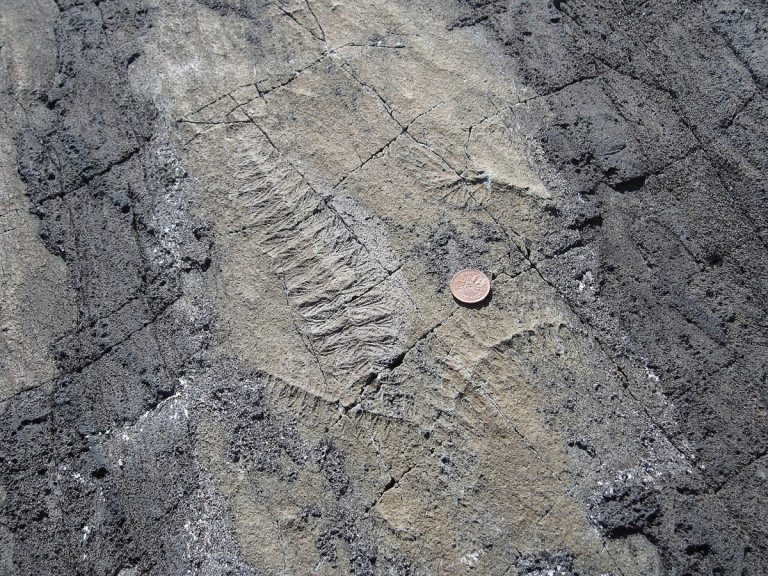
Ediacaran fossils at Mistaken Point, Newfoundland, photographed in 2009.
CA-K111Places & geography

Mistaken Point’s 560-million-year-old fossils

Mistaken Point, on the southeastern tip of Newfoundland, was inscribed as a UNESCO World Heritage Site in 2016. Its fossils, 580 to 560 million years old, include the world’s oldest-known examples of large, architecturally complex organisms.

Factual accuracy review: No recorded challenge

Contributor: Citizen.ca

Verified against cited sourcesVerified on 2026-10-26↗
Photo: Alicejmichel · Photo licence: CC BY-SA 4.0 · Credit & context
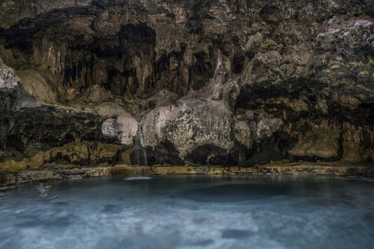
The cave pool at Cave and Basin National Historic Site, Banff, photographed in 2017.
CA-K109Places & geography

The Cave and Basin and Canada’s first national park

In 1885, the government created a 26 km² Hot Springs Reserve around the Cave and Basin hot springs in Banff. On 23 June 1887, the reserve was expanded to 665 km² and became Rocky Mountains National Park, the first national park in Canada.

Factual accuracy review: No recorded challenge

Contributor: Citizen.ca

Verified against cited sourcesVerified on 2026-10-26↗
Photo: Sovernigo · Photo licence: CC BY-SA 4.0 · Credit & context
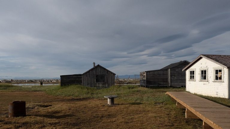
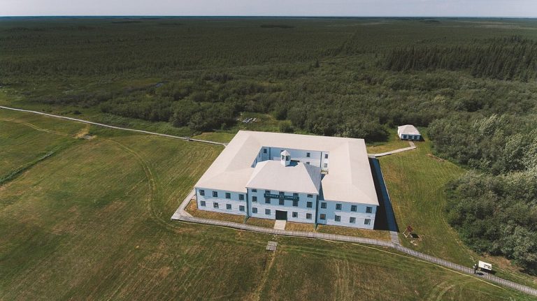
York Factory, Manitoba, photographed in 2017.
CA-K105Economy & trade

York Factory, a fur trade hub for over 250 years

York Factory, a Hudson’s Bay Company depot on Hudson Bay in Manitoba, was a vital fur trade hub for more than 250 years. It served as the gateway to the vast interior for British trade goods, settlers and soldiers, and lies on Treaty 5 territory.

Factual accuracy review: No recorded challenge

Contributor: Citizen.ca

Verified against cited sourcesVerified on 2026-10-26↗
Photo: Travel Manitoba · Photo licence: CC BY 2.0 · Credit & context
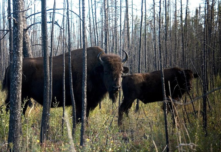
A wood bison in Wood Buffalo National Park, photographed in August 2007.
CA-K091Places & geography

Wood Buffalo, Canada’s largest national park

Wood Buffalo National Park, spanning the Alberta–Northwest Territories border, is the largest national park in Canada. It protects the world’s largest herds of wood bison and vital whooping crane habitat, in the traditional territory of the Dene, Cree and Métis.

Factual accuracy review: No recorded challenge

Contributor: Citizen.ca

Verified against cited sourcesVerified on 2026-10-26↗
Photo: Naturedata · Photo licence: CC0 · Credit & context