An independent Canadian knowledge project

Focused and Verified

Canadian knowledge base

Search by keyword

Choose one keyword, or combine two. Broader keywords include their descendants.

Keywords: Work, economy and infrastructure

Clear search
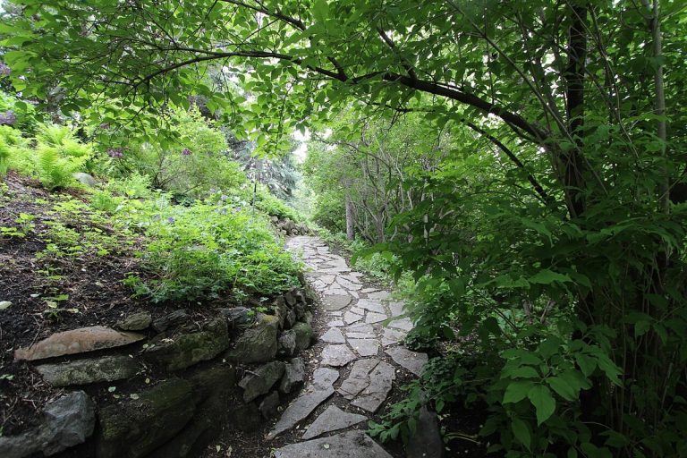
A stone path through Reader Rock Garden in Calgary, photographed in 2014.
CA-K380Places & geography

Reader Rock Garden, Calgary

Reader Rock Garden in Calgary is an Arts and Crafts-style alpine rockery laid out on a steep hillside by William R. Reader, the city’s parks superintendent from 1913 to 1942. Its planting beds tested and showed off what could grow in Calgary, challenging the belief that southern Alberta’s climate was too harsh for agriculture and horticulture.

Factual accuracy review: No recorded challenge

Contributor: Citizen.ca

Verified against cited sourcesVerified on 2026-10-26↗
Photo: Thank you for visiting my page from Canada · Photo licence: CC BY 2.0 · Credit & context
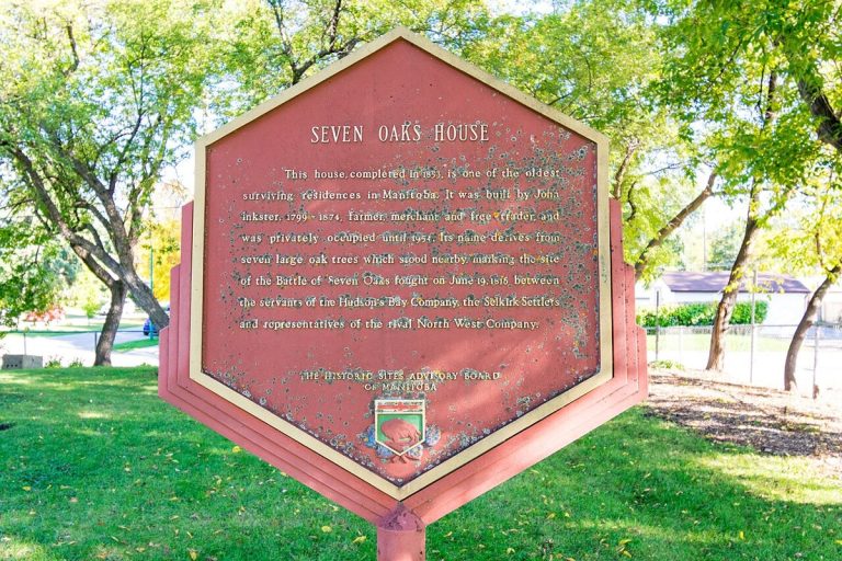
A historical plaque at Seven Oaks House Museum in Winnipeg, Manitoba, photographed in 2017.
CA-K376Indigenous peoples & reconciliation

Seven Oaks House and the Inkster family of Red River

Seven Oaks House in Winnipeg, in the Métis homeland and on Treaty 1 territory, includes a cabin of about 1831 built in Red River frame style and a Georgian house of 1851–1853. Home to the Scottish and Métis Inkster family, it shows the centrality of Métis families in the Red River community and the shift from the fur trade to farming and town life.

Factual accuracy review: No recorded challenge

Contributor: Citizen.ca

Verified against cited sourcesVerified on 2026-10-26↗
Photo: Jessica Losorata · Photo licence: CC BY-SA 4.0 · Credit & context
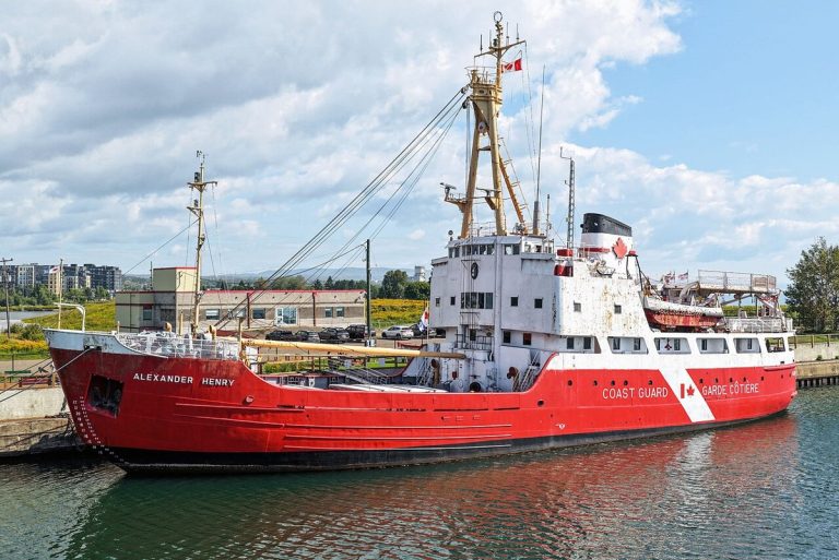
The former CCGS Alexander Henry, preserved in Thunder Bay, Ontario, photographed in 2026.
CA-K374History

CCGS Alexander Henry, Lake Superior icebreaker

The CCGS Alexander Henry, launched at Port Arthur (now Thunder Bay) in 1958, was the main Canadian icebreaker on Lake Superior from 1959 to 1985 and part of the first Canadian Coast Guard fleet in 1962. The red and white ship broke ice to lengthen the shipping season, supplied lighthouses, maintained buoys and carried out search and rescue.

Factual accuracy review: No recorded challenge

Contributor: Citizen.ca

Verified against cited sourcesVerified on 2026-10-26↗
Photo: Quintin Soloviev · Photo licence: CC BY 4.0 · Credit & context
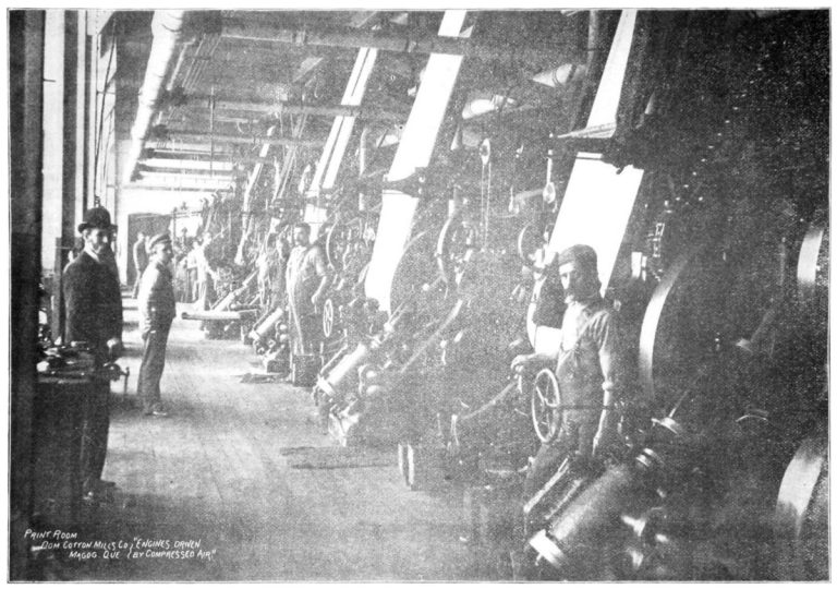
The print room of the Magog cotton mill in 1897.
CA-K373Economy & trade

The Magog Textile Mill, Canada’s first cotton printing

The Magog Textile Mill in Quebec, built in 1883 on the Magog River, began printing cotton in 1884 and was the country’s only cotton-printing mill until 1899. It was the only 19th-century mill where spinning, weaving, bleaching and printing were all done at one site; as part of Dominion Textile it employed 2,300 people by 1943.

Factual accuracy review: No recorded challenge

Contributor: Citizen.ca

Verified against cited sourcesVerified on 2026-10-26↗
Photo: Charles Havelock Taylor (1859-1953) · Photo licence: Public domain · Credit & context
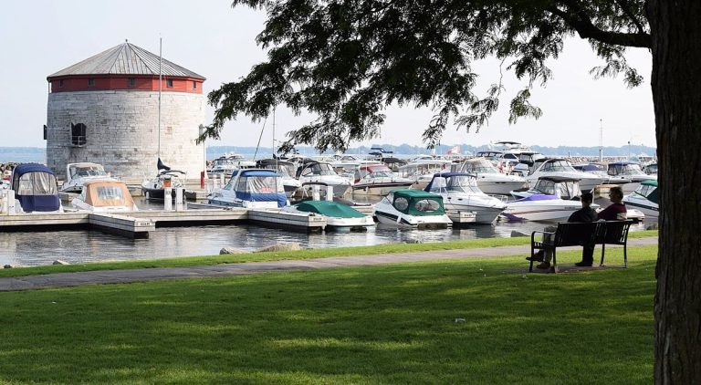
Shoal Tower in Kingston harbour, Ontario, photographed in 2017.
CA-K362History

Shoal Tower, a Kingston Martello tower

Shoal Tower in Kingston’s harbour was built by the British government in 1846–1847 as one of four Martello towers, with the Market Battery, to reinforce Kingston’s defences against an anticipated American threat during the Oregon Crisis. It is part of the Kingston Fortifications, linked to the town’s military importance and the Great Lakes–Rideau Canal route.

Factual accuracy review: No recorded challenge

Contributor: Citizen.ca

Verified against cited sourcesVerified on 2026-10-26↗
Photo: Mark · Photo licence: CC BY 2.0 · Credit & context
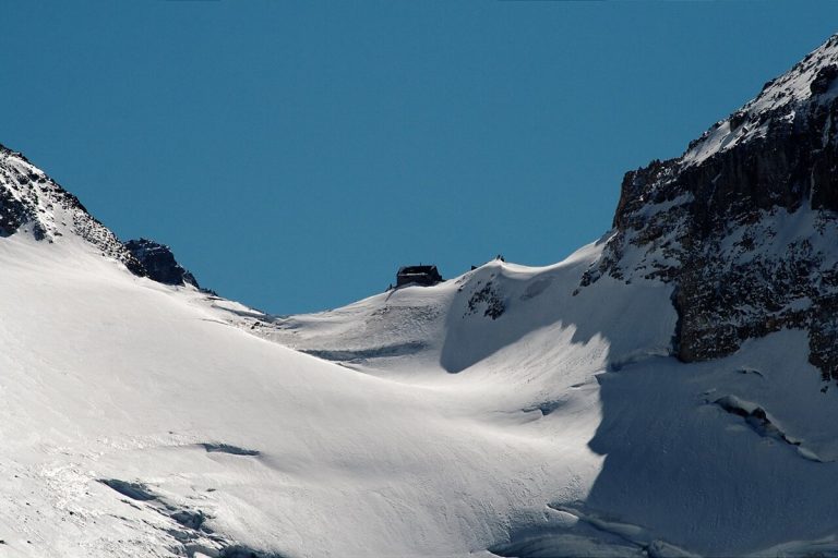
Abbot Pass and the refuge hut, seen from the Alberta side in 2010, before its demolition.
CA-K361Places & geography

The Abbot Pass Refuge Cabin, lost to erosion

The rustic stone Abbot Pass Refuge Cabin, built by the Canadian Pacific Railway in 1922 high in the Rockies between Mount Lefroy and Mount Victoria, sheltered hikers and mountaineers from 1923 until 2018. Erosion of the slope, accelerated by climate change, made the hut unstable and forced its demolition in 2022.

Factual accuracy review: No recorded challenge

Contributor: Citizen.ca

Verified against cited sourcesVerified on 2026-10-26↗
Photo: Florin Chelaru · Photo licence: CC BY 2.0 · Credit & context
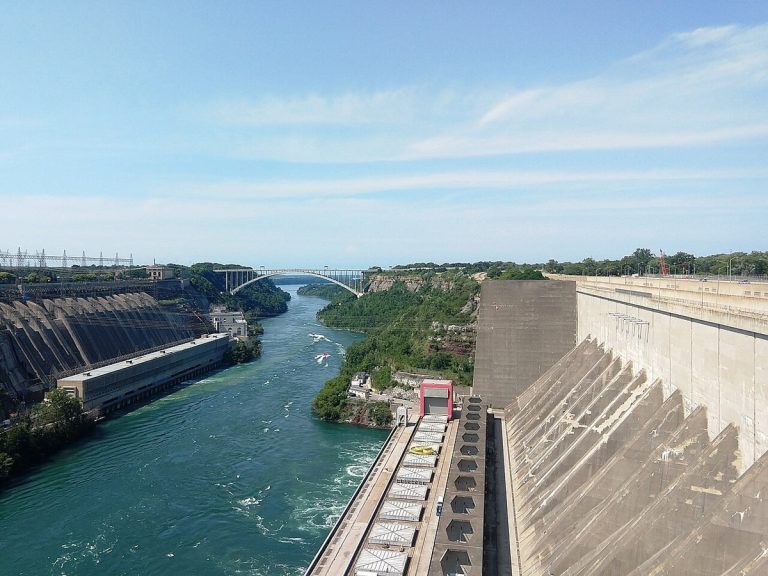
The Sir Adam Beck generating stations at Queenston (Ontario side) with the Robert Moses plant across the Niagara River, photographed in 2023.
CA-K355Economy & trade

The Queenston-Chippawa hydro-electric development

The Queenston-Chippawa hydro-electric development on the Niagara River, planned by Ontario’s Hydro-Electric Power Commission to meet rising demand in Toronto and southwestern Ontario, was an early hydro-electric mega-project. It required construction equipment, power units and a power canal on a scale not seen before.

Factual accuracy review: No recorded challenge

Contributor: Citizen.ca

Verified against cited sourcesVerified on 2026-10-26↗
Photo: Mr. Matté (if there is an issue with this image, contact me using this image's Commons talk page, my Commons user talk page, or my English Wikipedia user talk page; I'll know about it a lot faster) · Photo licence: CC BY-SA 4.0 · Credit & context
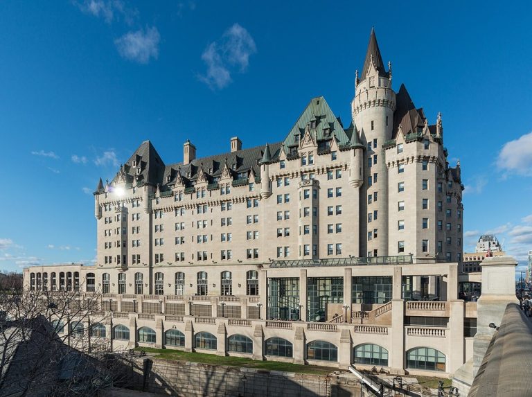
The Château Laurier in Ottawa, south view, photographed in 2017.
CA-K351Culture & sport

Château Laurier and the Château style

The Château Laurier in Ottawa, built between 1908 and 1912, was the first of a series of hotels by the Grand Trunk Pacific Railway to draw tourists to its transcontinental routes. The Château style of Canadian railway hotels evolved into a distinctly Canadian architectural type, and the hotel’s closeness to Parliament made it a model for that style.

Factual accuracy review: No recorded challenge

Contributor: Citizen.ca

Verified against cited sourcesVerified on 2026-10-26↗
Photo: DXR · Photo licence: CC BY-SA 4.0 · Credit & context
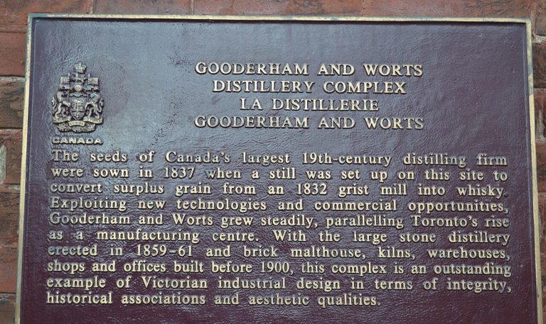
A commemorative plaque for the Gooderham and Worts Distillery in Toronto, photographed in 2015.
CA-K350Economy & trade

The Gooderham and Worts Distillery, Toronto

The Gooderham and Worts Distillery complex in Toronto is an imposing landmark whose buildings together bear witness to the evolution of the Canadian distilling industry. It is remarkably complete, illustrating the whole distilling process from processing raw materials to storing finished products for export.

Factual accuracy review: No recorded challenge

Contributor: Citizen.ca

Verified against cited sourcesVerified on 2026-10-26↗
Photo: Larry Koester · Photo licence: CC BY 2.0 · Credit & context
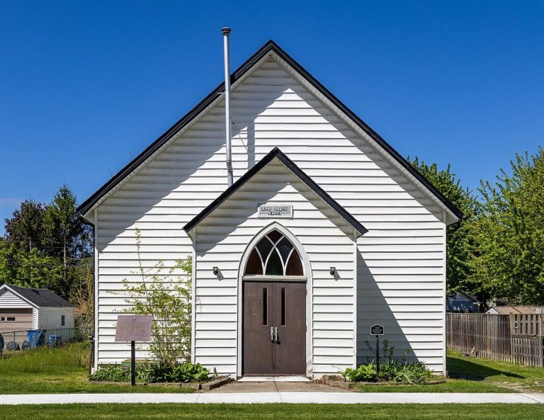
Amherstburg First Baptist Church in Amherstburg, Ontario, photographed in 2026.
CA-K348History

Amherstburg First Baptist Church

Amherstburg First Baptist Church, in Ontario, was a principal Underground Railroad-related Black church and a spiritual home for thousands of Black Baptists. As Mother Church of the Amherstburg Regular Missionary Baptist Association, it played a crucial role in developing Black communities and identity in Ontario.

Factual accuracy review: No recorded challenge

Contributor: Citizen.ca

Verified against cited sourcesVerified on 2026-10-26↗
Photo: Chris Woodrich · Photo licence: CC BY-SA 4.0 · Credit & context
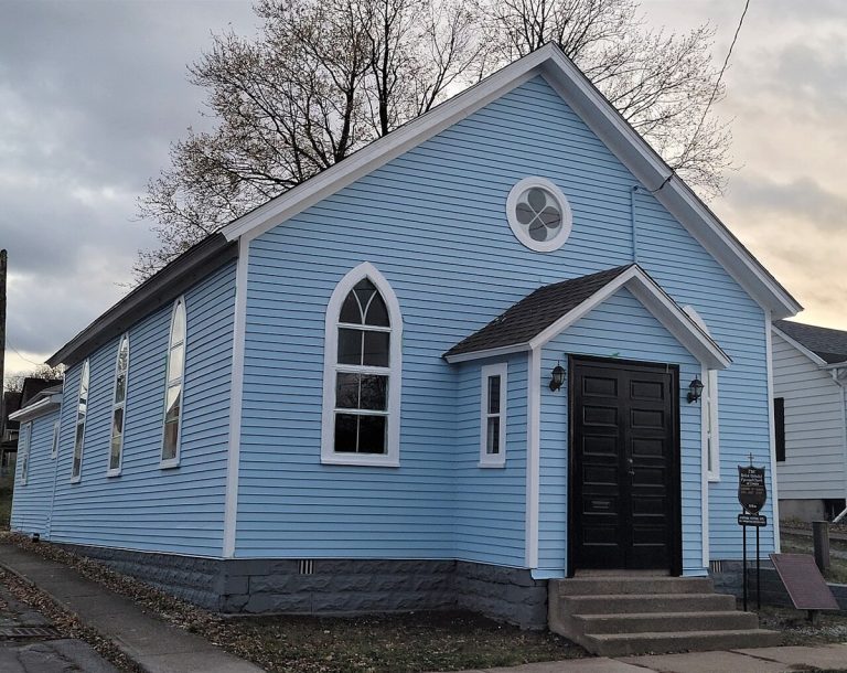
The R. Nathaniel Dett British Methodist Episcopal Church in Niagara Falls, Ontario, photographed in 2022.
CA-K347History

R. Nathaniel Dett BME Church, Niagara Falls

The R. Nathaniel Dett British Methodist Episcopal Church in Niagara Falls, Ontario, built in 1836 and later rolled on logs to its present site, illustrates early Black settlement in the Niagara area and the church’s role in receiving and sheltering Underground Railroad refugees. It is associated with the formative years of R. Nathaniel Dett, a leading figure in 20th-century North American sacred music.

Factual accuracy review: No recorded challenge

Contributor: Citizen.ca

Verified against cited sourcesVerified on 2026-10-26↗
Photo: Mhsheikholeslami · Photo licence: CC BY-SA 4.0 · Credit & context
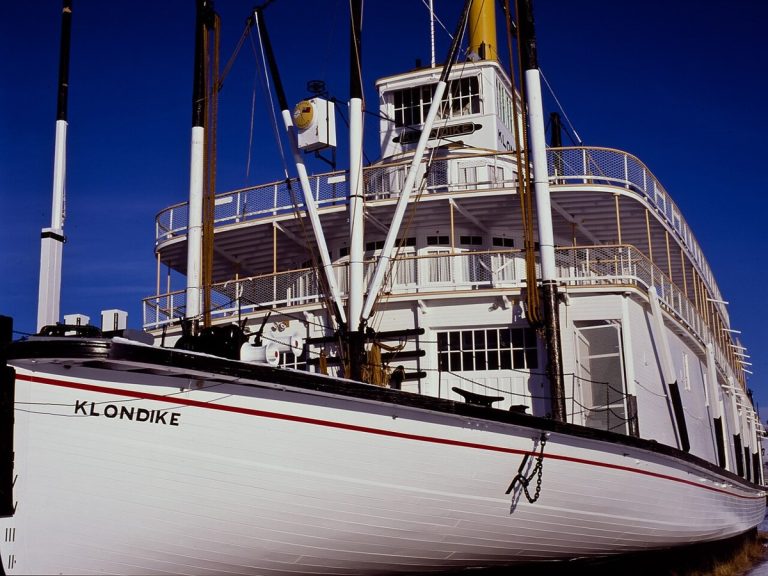
The S.S. Klondike in Whitehorse, Yukon, photographed in winter 2012.
CA-K338History

The S.S. Klondike sternwheeler

The S.S. Klondike, a shallow-draft sternwheeler launched in 1937, carried freight and passengers on the Yukon River until 1955, shortly before commercial navigation on the river ended in 1957. Restored by Parks Canada in Whitehorse, it commemorates inland water transportation in the Yukon.

Factual accuracy review: No recorded challenge

Contributor: Citizen.ca

Verified against cited sourcesVerified on 2026-10-26↗
Photo: Anthony DeLorenzo · Photo licence: CC BY-SA 3.0 · Credit & context
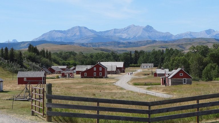
The Bar U Ranch National Historic Site, Alberta, seen from the interpretive centre in 2011.
CA-K336Economy & trade

The Bar U Ranch and Alberta ranching

The Bar U Ranch in the Alberta foothills was established in 1882 under the federal grazing lease policy and played an important role in Canada’s ranching industry. Owned in turn by the North-West Cattle Company, cattleman George Lane and Patrick Burns, the historic ranch represents Alberta ranching from 1880 to 1950.

Factual accuracy review: No recorded challenge

Contributor: Citizen.ca

Verified against cited sourcesVerified on 2026-10-26↗
Photo: David Mathew · Photo licence: CC BY-SA 3.0 · Credit & context
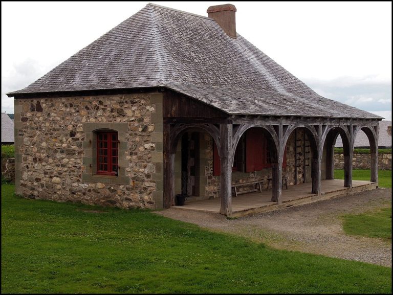
A reconstructed building at the Fortress of Louisbourg, Nova Scotia, photographed in 2016.
CA-K334History

The Fortress of Louisbourg

The Fortress of Louisbourg, on Cape Breton Island, was established by France as a critical fishing, trans-shipment and supply port and served as administrative capital of Île Royale, with a government, garrison and civilian population. Between 1713 and 1768 it was a place of profound significance in the struggle between France and Britain for empire.

Factual accuracy review: No recorded challenge

Contributor: Citizen.ca

Verified against cited sourcesVerified on 2026-10-26↗
Photo: KenCLeBlanc · Photo licence: CC BY-SA 4.0 · Credit & context
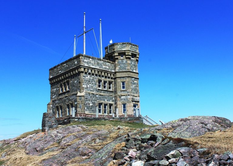
Cabot Tower on Signal Hill, St. John’s, Newfoundland and Labrador, photographed in 2013.
CA-K333History

Signal Hill and Marconi’s 1901 transmission

Signal Hill, overlooking the Narrows into St. John’s Harbour, was important for defence and communications for three centuries, with fortifications built as France and Britain battled for the continent. In 1901, Guglielmo Marconi received the first transatlantic wireless transmission atop the hill, a landmark in global communications history.

Factual accuracy review: No recorded challenge

Contributor: Citizen.ca

Verified against cited sourcesVerified on 2026-10-26↗
Photo: KristaKals · Photo licence: CC BY-SA 3.0 · Credit & context
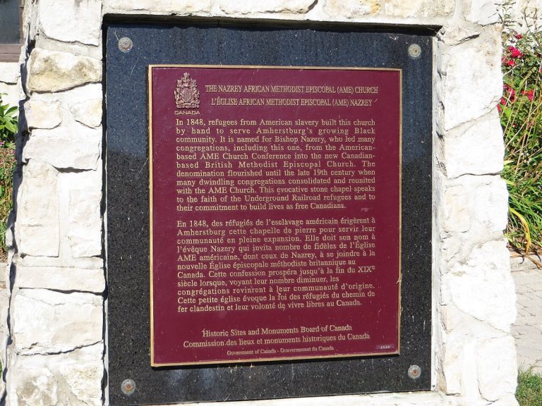
A commemorative plaque at the Nazrey African Methodist Episcopal Church in Amherstburg, Ontario, photographed in 2015.
CA-K330History

Nazrey AME Church, Amherstburg

In 1848, refugees from American slavery built the Nazrey African Methodist Episcopal Church by hand to serve Amherstburg’s growing Black community. The stone chapel is perhaps the building type most representative of Underground Railroad communities, and it is associated with Bishop Willis Nazrey, first leader of the British Methodist Episcopal Church, a wholly Canadian denomination founded by Underground Railroad refugees.

Factual accuracy review: No recorded challenge

Contributor: Citizen.ca

Verified against cited sourcesVerified on 2026-10-26↗
Photo: Ken Lund from Reno, Nevada, USA · Photo licence: CC BY-SA 2.0 · Credit & context
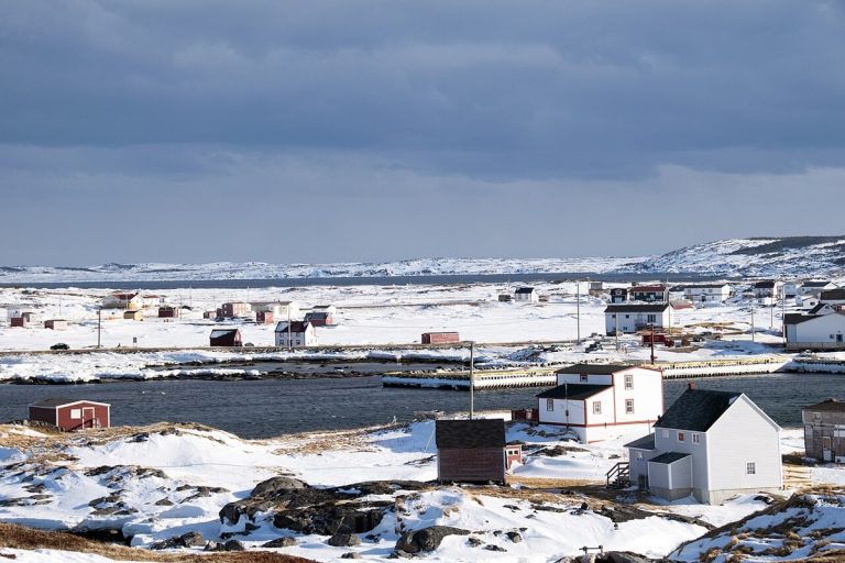
Tilting seen from Tilting Harbour, Fogo Island, photographed in 2017.
CA-K320Places & geography

Tilting, an Irish outport on Fogo Island

Tilting, a fishing community on the east coast of Fogo Island off Newfoundland’s northeast coast, is a living outport landscape of small wooden houses, outbuildings, gardens and pathways around its harbour. Its family neighbourhood clusters and fenced gardens illustrate adaptations of Irish settlement patterns and traditional outport life.

Factual accuracy review: No recorded challenge

Contributor: Citizen.ca

Verified against cited sourcesVerified on 2026-10-26↗
Photo: Paul Asman and Jill Lenoble · Photo licence: CC BY 2.0 · Credit & context
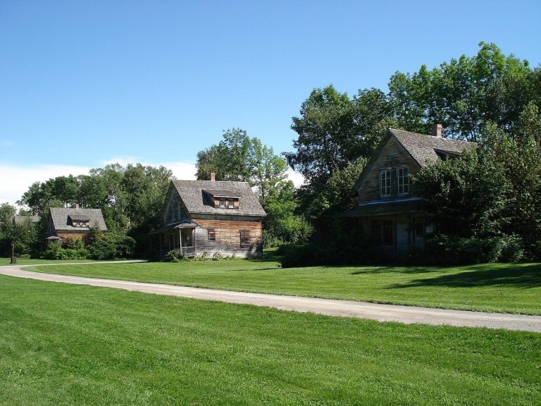
Houses in the ghost town of Val-Jalbert, Quebec, photographed in 2008.
CA-K319Economy & trade

Val-Jalbert, a pulp and paper company town

Val-Jalbert, near Lac Saint-Jean in Quebec, was founded in 1901 around a pulp and paper mill. The mill’s closure in 1927 led to the village’s gradual abandonment. Its mill, institutional buildings and wooden workers’ houses were conserved and developed as an open-air museum in the early 1960s, reflecting growing interest in heritage preservation.

Factual accuracy review: No recorded challenge

Contributor: Citizen.ca

Verified against cited sourcesVerified on 2026-10-26↗
Photo: Mathieu BROSSAIS · Photo licence: CC BY 4.0 · Credit & context
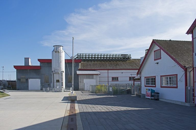
The Gulf of Georgia Cannery in Steveston, Richmond, British Columbia, photographed in 2019.
CA-K318Economy & trade

The Gulf of Georgia Cannery, Steveston

The Gulf of Georgia Cannery, a large complex of wooden fish-processing and canning buildings on a wharf at the mouth of the Fraser River in Steveston, British Columbia, recalls the West Coast fishing industry from the 1870s on. Its buildings, built and modified between 1894 and 1964, stand in what was historically the most important fishing village on the West Coast.

Factual accuracy review: No recorded challenge

Contributor: Citizen.ca

Verified against cited sourcesVerified on 2026-10-26↗
Photo: Ymblanter · Photo licence: CC BY-SA 4.0 · Credit & context
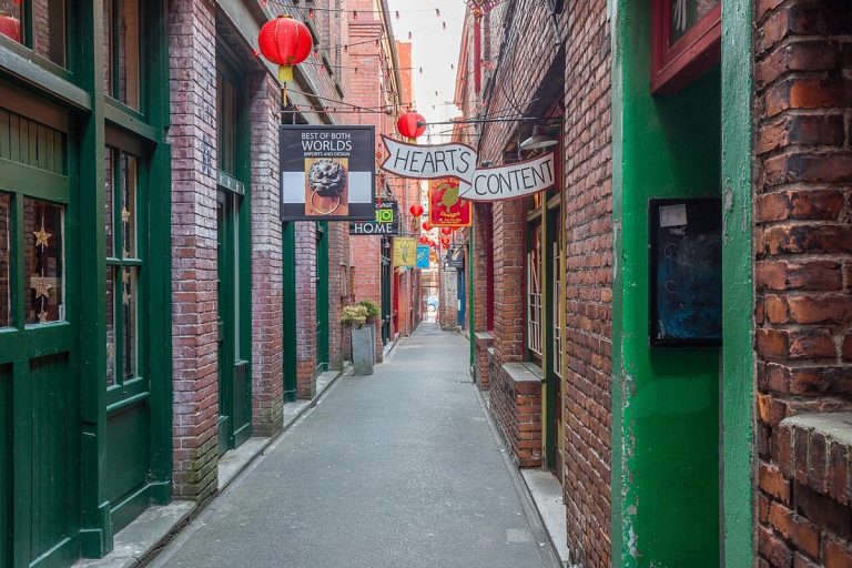
Fan Tan Alley in Victoria’s Chinatown, photographed in 2018.
CA-K315History

Victoria’s Chinatown, the oldest in Canada

Victoria’s Chinatown is the oldest surviving Chinatown in Canada. Before the Canadian Pacific Railway was completed, Victoria was a major port of entry for Chinese immigrants, and the neighbourhood became an important centre of Chinese Canadian community life.

Factual accuracy review: No recorded challenge

Contributor: Citizen.ca

Verified against cited sourcesVerified on 2026-10-26↗
Photo: Michal Klajban · Photo licence: CC BY-SA 4.0 · Credit & context
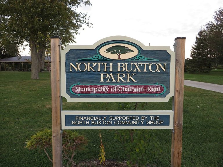
A sign for North Buxton Park in the Buxton Settlement area, Ontario, photographed in 2015; it does not show the settlement’s original buildings.
CA-K312History

The Buxton Settlement, a planned refugee community

The Buxton Settlement National Historic Site in southwestern Ontario encompasses a cultural landscape of about 4,680 hectares, including North and South Buxton. Its farms, religious institutions and schools preserve the history of a planned settlement founded by Underground Railroad refugees and remain a living memorial to its founders.

Factual accuracy review: No recorded challenge

Contributor: Citizen.ca

Verified against cited sourcesVerified on 2026-10-26↗
Photo: Ken Lund from Reno, Nevada, USA · Photo licence: CC BY-SA 2.0 · Credit & context
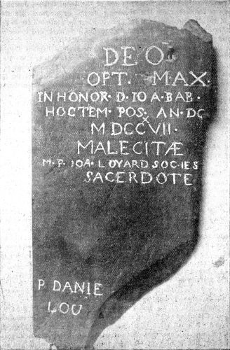
A stone tablet dated 1717 from the French mission chapel at Meductic, as recorded around 1897.
CA-K307Indigenous peoples & reconciliation

Mehtawtik (Meductic), a Wolastoqey village

Mehtawtik (Meductic), on the west bank of the Wəlastəkw (Saint John River) in New Brunswick, was the principal settlement of the Wəlastəkwiyik (Maliseet) from before the 17th century, valued for hunting, fishing and fertile soil where families planted corn. The village site has been under the waters of the Mactaquac hydroelectric dam since 1968.

Factual accuracy review: No recorded challenge

Contributor: Citizen.ca

Verified against cited sourcesVerified on 2026-10-26↗
Photo: W.O. Raymond. · Photo licence: Public domain · Credit & context
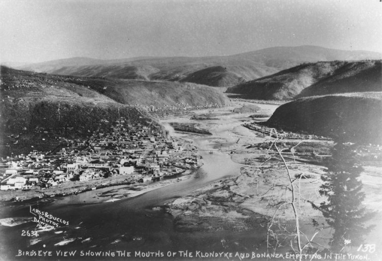
The mouths of Bonanza Creek and the Klondike River at the Yukon River, photographed in 1900 by Larss & Duclos.
CA-K306Indigenous peoples & reconciliation

Tr’ochëk, “the place at the mouth of the river”

Tr’ochëk, at the confluence of the Yukon and Klondike rivers just south of Dawson City, represents the Hän cultural landscape of the middle Yukon River valley. For countless generations the Hän spent mid-summer to late fall at fishing camps there; its name means “the place at the mouth of the river,” and it is the Tr’ondëk Hwëch’in “home” on the Yukon River.

Factual accuracy review: No recorded challenge

Contributor: Citizen.ca

Verified against cited sourcesVerified on 2026-10-26↗
Photo: Larss & Duclos · Photo licence: CC BY-SA 4.0 · Credit & context
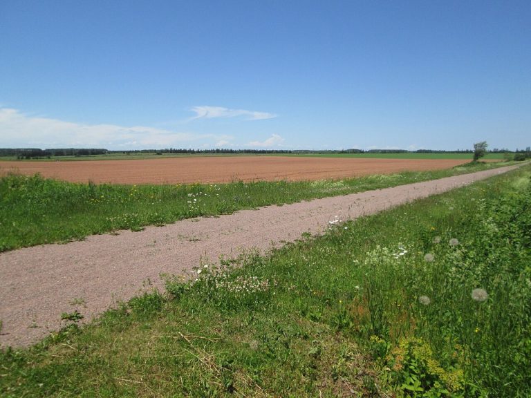
The Confederation Trail, on the former railway roadbed, at Freetown, Prince Edward Island, in 2017.
CA-K284History

The Prince Edward Island Railway and Confederation

The Prince Edward Island Railway was built between 1871 and 1875 to bring economic growth and better communications. Its costs threatened the colony with bankruptcy, and in 1873, after Ottawa agreed to pay for completing the line, Prince Edward Island joined Confederation; after service ended, its roadbed became part of the Confederation Trail.

Factual accuracy review: No recorded challenge

Contributor: Citizen.ca

Verified against cited sourcesVerified on 2026-10-26↗
Photo: Larry from Charlottetown, PEI, Canada · Photo licence: CC BY 2.0 · Credit & context